AAK Ala Archa, Kyrgyzstan - Earthquake Result Viewer
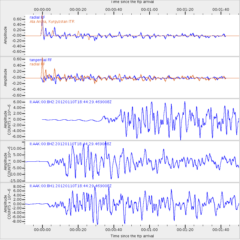
Earthquake location: Off W Coast Of Northern Sumatra
Earthquake latitude/longitude: 2.4/93.2
Earthquake time(UTC): 2012/01/10 (010) 18:36:59 GMT
Earthquake Depth: 19 km
Earthquake Magnitude: 6.6 MB, 7.0 MS, 7.2 MW, 7.2 MW
Earthquake Catalog/Contributor: WHDF/NEIC
Network: II Global Seismograph Network (GSN - IRIS/IDA)
Station: AAK Ala Archa, Kyrgyzstan
Lat/Lon: 42.64 N/74.49 E
Elevation: 1645 m
Distance: 43.4 deg
Az: 339.838 deg
Baz: 152.18 deg
Ray Param: 0.0725603
Estimated Moho Depth: 59.25 km
Estimated Crust Vp/Vs: 1.69
Assumed Crust Vp: 6.306 km/s
Estimated Crust Vs: 3.742 km/s
Estimated Crust Poisson's Ratio: 0.23
Radial Match: 94.213234 %
Radial Bump: 400
Transverse Match: 89.5252 %
Transverse Bump: 400
SOD ConfigId: 558545
Insert Time: 2013-09-19 09:36:52.666 +0000
GWidth: 2.5
Max Bumps: 400
Tol: 0.001

Signal To Noise

ChannelStoNSTALTA
II:AAK:00:BHZ:20120110T18:44:29.469008Z8.4058661.4673035E-61.7455709E-7
II:AAK:00:BH1:20120110T18:44:29.469008Z3.0927935.1651546E-71.6700615E-7
II:AAK:00:BH2:20120110T18:44:29.469008Z4.0559225.982598E-71.4750279E-7
Arrivals
Ps6.9 SECOND
PpPs24 SECOND
PsPs/PpSs30 SECOND