
MAJO Matsushiro, Japan - Earthquake Result Viewer
| ||||||||||||||||||
| ||||||||||||||||||
| ||||||||||||||||||
|
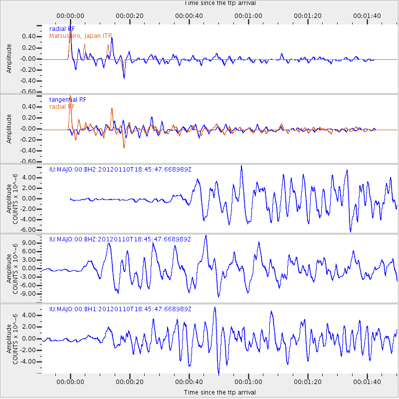
Signal To Noise
| Channel | StoN | STA | LTA |
| IU:MAJO:00:BHZ:20120110T18:45:47.668989Z | 2.948944 | 5.908997E-7 | 2.0037669E-7 |
| IU:MAJO:00:BH1:20120110T18:45:47.668989Z | 1.0748335 | 2.3289742E-7 | 2.1668232E-7 |
| IU:MAJO:00:BH2:20120110T18:45:47.668989Z | 2.7864535 | 3.7738076E-7 | 1.3543408E-7 |
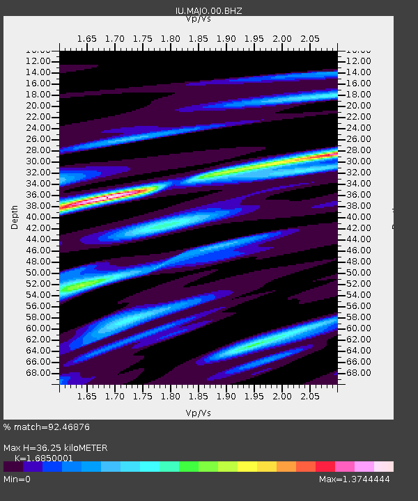
| Arrivals | |
| Ps | 4.1 SECOND |
| PpPs | 14 SECOND |
| PsPs/PpSs | 18 SECOND |

