You are here: Home > Network List > IU - Global Seismograph Network (GSN - IRIS/USGS) Stations List
> Station PMG Port Moresby, New Guinea > Earthquake Result Viewer
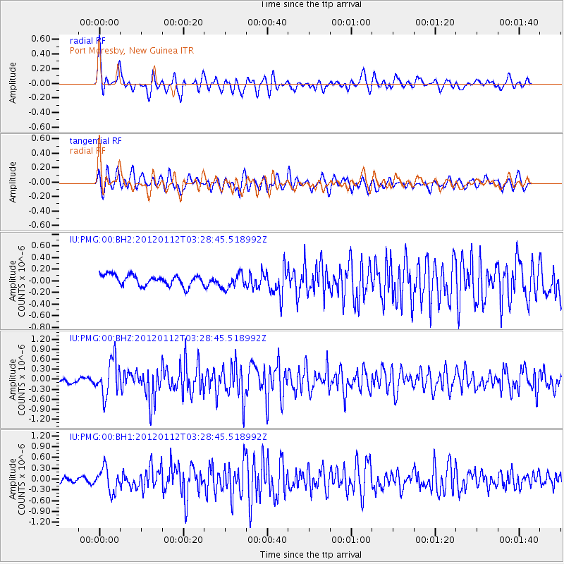
PMG Port Moresby, New Guinea - Earthquake Result Viewer
*The percent match for this event was below the threshold and hence no stack was calculated.
| Earthquake location: |
Near East Coast Of Honshu, Japan |
| Earthquake latitude/longitude: |
37.0/141.1 |
| Earthquake time(UTC): |
2012/01/12 (012) 03:20:49 GMT |
| Earthquake Depth: |
16 km |
| Earthquake Magnitude: |
6.0 MB, 5.2 MS, 5.5 MW, 5.5 MW |
| Earthquake Catalog/Contributor: |
WHDF/NEIC |
|
| Network: |
IU Global Seismograph Network (GSN - IRIS/USGS) |
| Station: |
PMG Port Moresby, New Guinea |
| Lat/Lon: |
9.40 S/147.16 E |
| Elevation: |
90 m |
|
| Distance: |
46.5 deg |
| Az: |
171.705 deg |
| Baz: |
353.277 deg |
| Ray Param: |
$rayparam |
*The percent match for this event was below the threshold and hence was not used in the summary stack. |
|
| Radial Match: |
69.70357 % |
| Radial Bump: |
400 |
| Transverse Match: |
65.918274 % |
| Transverse Bump: |
400 |
| SOD ConfigId: |
558545 |
| Insert Time: |
2013-09-19 09:40:21.691 +0000 |
| GWidth: |
2.5 |
| Max Bumps: |
400 |
| Tol: |
0.001 |
|
Signal To Noise
| Channel | StoN | STA | LTA |
| IU:PMG:00:BHZ:20120112T03:28:45.518992Z | 7.29349 | 5.4062286E-7 | 7.412403E-8 |
| IU:PMG:00:BH1:20120112T03:28:45.518992Z | 4.830658 | 3.3658839E-7 | 6.967754E-8 |
| IU:PMG:00:BH2:20120112T03:28:45.518992Z | 1.3989352 | 1.2642917E-7 | 9.037528E-8 |
| Arrivals |
| Ps | |
| PpPs | |
| PsPs/PpSs | |


