You are here: Home > Network List > IU - Global Seismograph Network (GSN - IRIS/USGS) Stations List
> Station RSSD Black Hills, South Dakota, USA > Earthquake Result Viewer
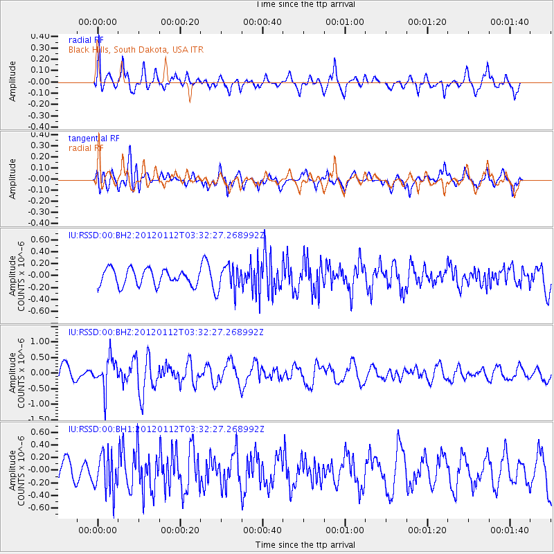
RSSD Black Hills, South Dakota, USA - Earthquake Result Viewer
*The percent match for this event was below the threshold and hence no stack was calculated.
| Earthquake location: |
Near East Coast Of Honshu, Japan |
| Earthquake latitude/longitude: |
37.0/141.1 |
| Earthquake time(UTC): |
2012/01/12 (012) 03:20:49 GMT |
| Earthquake Depth: |
16 km |
| Earthquake Magnitude: |
6.0 MB, 5.2 MS, 5.5 MW, 5.5 MW |
| Earthquake Catalog/Contributor: |
WHDF/NEIC |
|
| Network: |
IU Global Seismograph Network (GSN - IRIS/USGS) |
| Station: |
RSSD Black Hills, South Dakota, USA |
| Lat/Lon: |
44.12 N/104.04 W |
| Elevation: |
2090 m |
|
| Distance: |
80.0 deg |
| Az: |
41.551 deg |
| Baz: |
312.493 deg |
| Ray Param: |
$rayparam |
*The percent match for this event was below the threshold and hence was not used in the summary stack. |
|
| Radial Match: |
66.50452 % |
| Radial Bump: |
400 |
| Transverse Match: |
59.03756 % |
| Transverse Bump: |
400 |
| SOD ConfigId: |
558545 |
| Insert Time: |
2013-09-19 09:40:27.209 +0000 |
| GWidth: |
2.5 |
| Max Bumps: |
400 |
| Tol: |
0.001 |
|
Signal To Noise
| Channel | StoN | STA | LTA |
| IU:RSSD:00:BHZ:20120112T03:32:27.268992Z | 1.9256785 | 5.148052E-7 | 2.6733704E-7 |
| IU:RSSD:00:BH1:20120112T03:32:27.268992Z | 1.4815397 | 3.0166814E-7 | 2.03618E-7 |
| IU:RSSD:00:BH2:20120112T03:32:27.268992Z | 1.5760243 | 2.1013336E-7 | 1.333313E-7 |
| Arrivals |
| Ps | |
| PpPs | |
| PsPs/PpSs | |


