You are here: Home > Network List > US - United States National Seismic Network Stations List
> Station DGMT Dagmar, Montana, USA > Earthquake Result Viewer
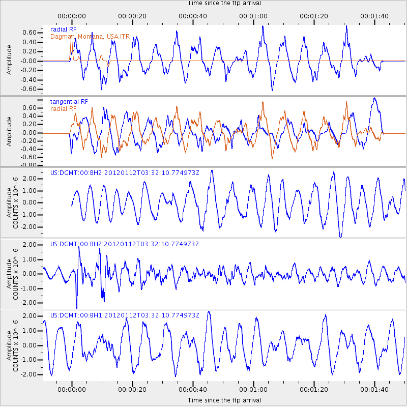
DGMT Dagmar, Montana, USA - Earthquake Result Viewer
*The percent match for this event was below the threshold and hence no stack was calculated.
| Earthquake location: |
Near East Coast Of Honshu, Japan |
| Earthquake latitude/longitude: |
37.0/141.1 |
| Earthquake time(UTC): |
2012/01/12 (012) 03:20:49 GMT |
| Earthquake Depth: |
16 km |
| Earthquake Magnitude: |
6.0 MB, 5.2 MS, 5.5 MW, 5.5 MW |
| Earthquake Catalog/Contributor: |
WHDF/NEIC |
|
| Network: |
US United States National Seismic Network |
| Station: |
DGMT Dagmar, Montana, USA |
| Lat/Lon: |
48.47 N/104.20 W |
| Elevation: |
0.0 m |
|
| Distance: |
77.0 deg |
| Az: |
38.334 deg |
| Baz: |
311.738 deg |
| Ray Param: |
$rayparam |
*The percent match for this event was below the threshold and hence was not used in the summary stack. |
|
| Radial Match: |
70.20667 % |
| Radial Bump: |
400 |
| Transverse Match: |
39.100403 % |
| Transverse Bump: |
383 |
| SOD ConfigId: |
558545 |
| Insert Time: |
2013-09-19 09:41:11.983 +0000 |
| GWidth: |
2.5 |
| Max Bumps: |
400 |
| Tol: |
0.001 |
|
Signal To Noise
| Channel | StoN | STA | LTA |
| US:DGMT:00:BHZ:20120112T03:32:10.774973Z | 1.8326534 | 8.7259207E-7 | 4.761359E-7 |
| US:DGMT:00:BH1:20120112T03:32:10.774973Z | 0.74861515 | 1.0973014E-6 | 1.4657751E-6 |
| US:DGMT:00:BH2:20120112T03:32:10.774973Z | 0.45239538 | 4.4772148E-7 | 9.896686E-7 |
| Arrivals |
| Ps | |
| PpPs | |
| PsPs/PpSs | |


