You are here: Home > Network List > US - United States National Seismic Network Stations List
> Station EGMT Eagleton, Montana, USA > Earthquake Result Viewer
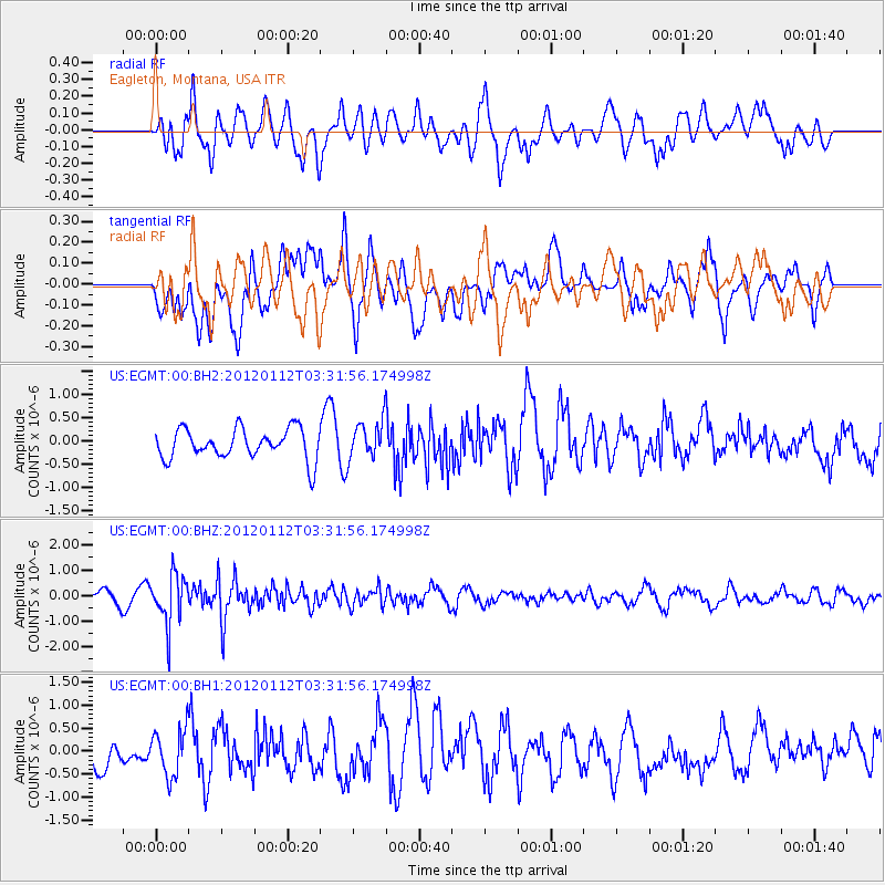
EGMT Eagleton, Montana, USA - Earthquake Result Viewer
*The percent match for this event was below the threshold and hence no stack was calculated.
| Earthquake location: |
Near East Coast Of Honshu, Japan |
| Earthquake latitude/longitude: |
37.0/141.1 |
| Earthquake time(UTC): |
2012/01/12 (012) 03:20:49 GMT |
| Earthquake Depth: |
16 km |
| Earthquake Magnitude: |
6.0 MB, 5.2 MS, 5.5 MW, 5.5 MW |
| Earthquake Catalog/Contributor: |
WHDF/NEIC |
|
| Network: |
US United States National Seismic Network |
| Station: |
EGMT Eagleton, Montana, USA |
| Lat/Lon: |
48.02 N/109.75 W |
| Elevation: |
1055 m |
|
| Distance: |
74.5 deg |
| Az: |
41.151 deg |
| Baz: |
308.295 deg |
| Ray Param: |
$rayparam |
*The percent match for this event was below the threshold and hence was not used in the summary stack. |
|
| Radial Match: |
54.725323 % |
| Radial Bump: |
400 |
| Transverse Match: |
49.121952 % |
| Transverse Bump: |
400 |
| SOD ConfigId: |
558545 |
| Insert Time: |
2013-09-19 09:41:22.167 +0000 |
| GWidth: |
2.5 |
| Max Bumps: |
400 |
| Tol: |
0.001 |
|
Signal To Noise
| Channel | StoN | STA | LTA |
| US:EGMT:00:BHZ:20120112T03:31:56.174998Z | 3.5928805 | 9.747644E-7 | 2.7130443E-7 |
| US:EGMT:00:BH1:20120112T03:31:56.174998Z | 1.7186903 | 5.030555E-7 | 2.92697E-7 |
| US:EGMT:00:BH2:20120112T03:31:56.174998Z | 1.2566247 | 4.0783385E-7 | 3.2454707E-7 |
| Arrivals |
| Ps | |
| PpPs | |
| PsPs/PpSs | |


