You are here: Home > Network List > CN - Canadian National Seismograph Network Stations List
> Station LLLB LILLOOET, BC, CANADA ADA > Earthquake Result Viewer
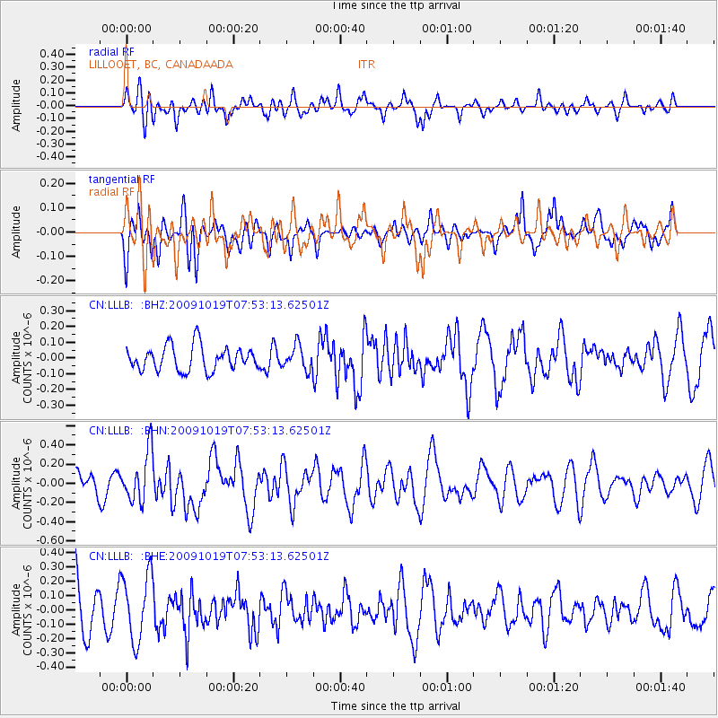
LLLB LILLOOET, BC, CANADA ADA - Earthquake Result Viewer
*The percent match for this event was below the threshold and hence no stack was calculated.
| Earthquake location: |
Samoa Islands Region |
| Earthquake latitude/longitude: |
-15.4/-173.0 |
| Earthquake time(UTC): |
2009/10/19 (292) 07:41:38 GMT |
| Earthquake Depth: |
10 km |
| Earthquake Magnitude: |
5.8 MW, 5.4 MS, 5.4 MB, 5.8 MW |
| Earthquake Catalog/Contributor: |
WHDF/NEIC |
|
| Network: |
CN Canadian National Seismograph Network |
| Station: |
LLLB LILLOOET, BC, CANADA ADA |
| Lat/Lon: |
50.61 N/121.88 W |
| Elevation: |
700 m |
|
| Distance: |
79.5 deg |
| Az: |
30.281 deg |
| Baz: |
229.748 deg |
| Ray Param: |
$rayparam |
*The percent match for this event was below the threshold and hence was not used in the summary stack. |
|
| Radial Match: |
55.325855 % |
| Radial Bump: |
400 |
| Transverse Match: |
38.878757 % |
| Transverse Bump: |
389 |
| SOD ConfigId: |
2622 |
| Insert Time: |
2010-02-27 06:39:32.009 +0000 |
| GWidth: |
2.5 |
| Max Bumps: |
400 |
| Tol: |
0.001 |
|
Signal To Noise
| Channel | StoN | STA | LTA |
| CN:LLLB: :BHN:20091019T07:53:13.62501Z | 2.511797 | 2.6459415E-7 | 1.05340575E-7 |
| CN:LLLB: :BHE:20091019T07:53:13.62501Z | 1.3617904 | 2.3037236E-7 | 1.6916873E-7 |
| CN:LLLB: :BHZ:20091019T07:53:13.62501Z | 0.9816683 | 7.6108726E-8 | 7.7529975E-8 |
| Arrivals |
| Ps | |
| PpPs | |
| PsPs/PpSs | |


