You are here: Home > Network List > CN - Canadian National Seismograph Network Stations List
> Station LLLB LILLOOET, BC, CANADA ADA > Earthquake Result Viewer
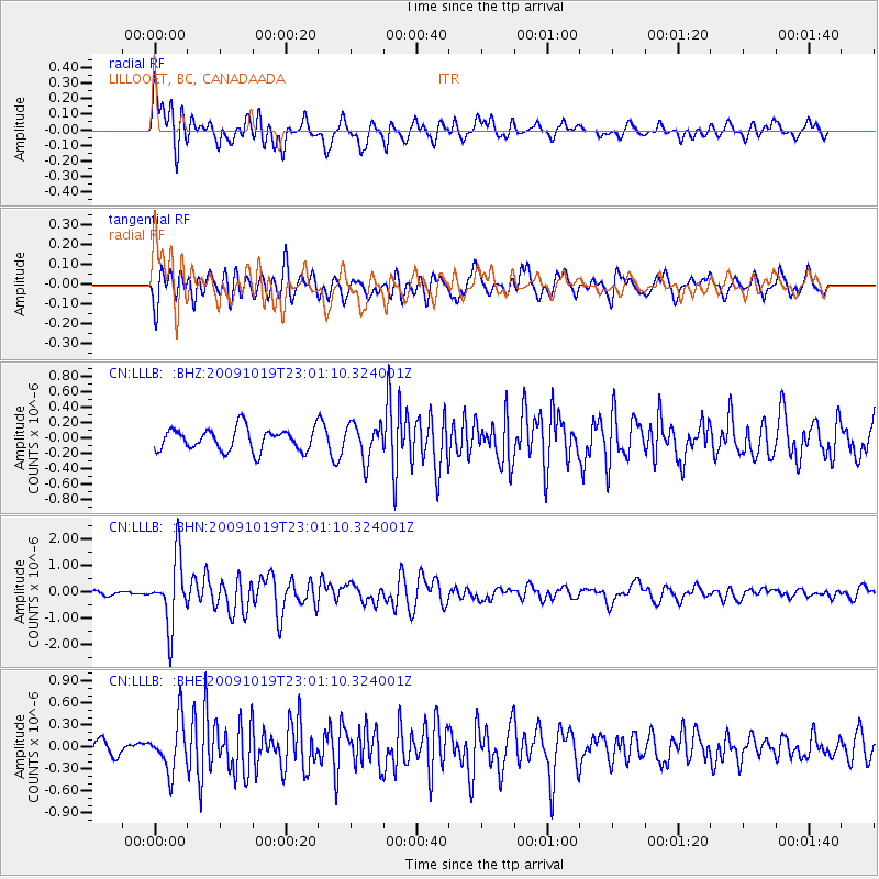
LLLB LILLOOET, BC, CANADA ADA - Earthquake Result Viewer
*The percent match for this event was below the threshold and hence no stack was calculated.
| Earthquake location: |
Samoa Islands Region |
| Earthquake latitude/longitude: |
-15.4/-172.3 |
| Earthquake time(UTC): |
2009/10/19 (292) 22:49:38 GMT |
| Earthquake Depth: |
18 km |
| Earthquake Magnitude: |
6.2 MB, 5.7 MS, 6.0 MW, 5.9 MW |
| Earthquake Catalog/Contributor: |
WHDF/NEIC |
|
| Network: |
CN Canadian National Seismograph Network |
| Station: |
LLLB LILLOOET, BC, CANADA ADA |
| Lat/Lon: |
50.61 N/121.88 W |
| Elevation: |
700 m |
|
| Distance: |
79.1 deg |
| Az: |
29.989 deg |
| Baz: |
229.183 deg |
| Ray Param: |
$rayparam |
*The percent match for this event was below the threshold and hence was not used in the summary stack. |
|
| Radial Match: |
78.97216 % |
| Radial Bump: |
400 |
| Transverse Match: |
68.56567 % |
| Transverse Bump: |
400 |
| SOD ConfigId: |
2622 |
| Insert Time: |
2010-02-27 06:39:33.720 +0000 |
| GWidth: |
2.5 |
| Max Bumps: |
400 |
| Tol: |
0.001 |
|
Signal To Noise
| Channel | StoN | STA | LTA |
| CN:LLLB: :BHN:20091019T23:01:10.324001Z | 8.040851 | 1.2710733E-6 | 1.5807697E-7 |
| CN:LLLB: :BHE:20091019T23:01:10.324001Z | 2.1951802 | 3.451067E-7 | 1.572111E-7 |
| CN:LLLB: :BHZ:20091019T23:01:10.324001Z | 1.5752945 | 2.2658071E-7 | 1.4383387E-7 |
| Arrivals |
| Ps | |
| PpPs | |
| PsPs/PpSs | |


