You are here: Home > Network List > IU - Global Seismograph Network (GSN - IRIS/USGS) Stations List
> Station RSSD Black Hills, South Dakota, USA > Earthquake Result Viewer
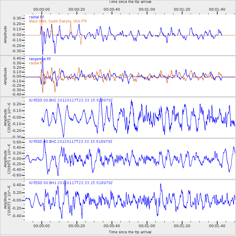
RSSD Black Hills, South Dakota, USA - Earthquake Result Viewer
*The percent match for this event was below the threshold and hence no stack was calculated.
| Earthquake location: |
Near Coast Of Central Chile |
| Earthquake latitude/longitude: |
-31.7/-71.5 |
| Earthquake time(UTC): |
2012/01/17 (017) 23:21:35 GMT |
| Earthquake Depth: |
33 km |
| Earthquake Magnitude: |
5.6 MW, 5.5 MB, 5.6 MW |
| Earthquake Catalog/Contributor: |
NEIC PDE/NEIC PDE-M |
|
| Network: |
IU Global Seismograph Network (GSN - IRIS/USGS) |
| Station: |
RSSD Black Hills, South Dakota, USA |
| Lat/Lon: |
44.12 N/104.04 W |
| Elevation: |
2090 m |
|
| Distance: |
81.1 deg |
| Az: |
336.913 deg |
| Baz: |
152.334 deg |
| Ray Param: |
$rayparam |
*The percent match for this event was below the threshold and hence was not used in the summary stack. |
|
| Radial Match: |
65.60422 % |
| Radial Bump: |
400 |
| Transverse Match: |
73.66083 % |
| Transverse Bump: |
400 |
| SOD ConfigId: |
558545 |
| Insert Time: |
2013-09-19 09:55:42.676 +0000 |
| GWidth: |
2.5 |
| Max Bumps: |
400 |
| Tol: |
0.001 |
|
Signal To Noise
| Channel | StoN | STA | LTA |
| IU:RSSD:00:BHZ:20120117T23:33:15.618979Z | 2.882049 | 3.322386E-7 | 1.1527862E-7 |
| IU:RSSD:00:BH1:20120117T23:33:15.618979Z | 1.496273 | 1.4286124E-7 | 9.547806E-8 |
| IU:RSSD:00:BH2:20120117T23:33:15.618979Z | 1.6571373 | 1.556464E-7 | 9.3924875E-8 |
| Arrivals |
| Ps | |
| PpPs | |
| PsPs/PpSs | |


