You are here: Home > Network List > US - United States National Seismic Network Stations List
> Station COWI Conover, Wisconsin, USA > Earthquake Result Viewer
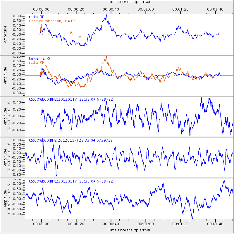
COWI Conover, Wisconsin, USA - Earthquake Result Viewer
*The percent match for this event was below the threshold and hence no stack was calculated.
| Earthquake location: |
Near Coast Of Central Chile |
| Earthquake latitude/longitude: |
-31.7/-71.5 |
| Earthquake time(UTC): |
2012/01/17 (017) 23:21:35 GMT |
| Earthquake Depth: |
33 km |
| Earthquake Magnitude: |
5.6 MW, 5.5 MB, 5.6 MW |
| Earthquake Catalog/Contributor: |
NEIC PDE/NEIC PDE-M |
|
| Network: |
US United States National Seismic Network |
| Station: |
COWI Conover, Wisconsin, USA |
| Lat/Lon: |
46.10 N/89.14 W |
| Elevation: |
523 m |
|
| Distance: |
79.0 deg |
| Az: |
347.599 deg |
| Baz: |
164.739 deg |
| Ray Param: |
$rayparam |
*The percent match for this event was below the threshold and hence was not used in the summary stack. |
|
| Radial Match: |
51.639275 % |
| Radial Bump: |
400 |
| Transverse Match: |
39.93041 % |
| Transverse Bump: |
400 |
| SOD ConfigId: |
558545 |
| Insert Time: |
2013-09-19 09:56:23.556 +0000 |
| GWidth: |
2.5 |
| Max Bumps: |
400 |
| Tol: |
0.001 |
|
Signal To Noise
| Channel | StoN | STA | LTA |
| US:COWI:00:BHZ:20120117T23:33:04.673972Z | 1.948539 | 3.9666588E-7 | 2.0357093E-7 |
| US:COWI:00:BH1:20120117T23:33:04.673972Z | 1.5036737 | 3.1624913E-7 | 2.1031765E-7 |
| US:COWI:00:BH2:20120117T23:33:04.673972Z | 1.4078879 | 2.0328987E-7 | 1.443935E-7 |
| Arrivals |
| Ps | |
| PpPs | |
| PsPs/PpSs | |


