You are here: Home > Network List > US - United States National Seismic Network Stations List
> Station WMOK Wichita Mountains, Oklahoma, USA > Earthquake Result Viewer
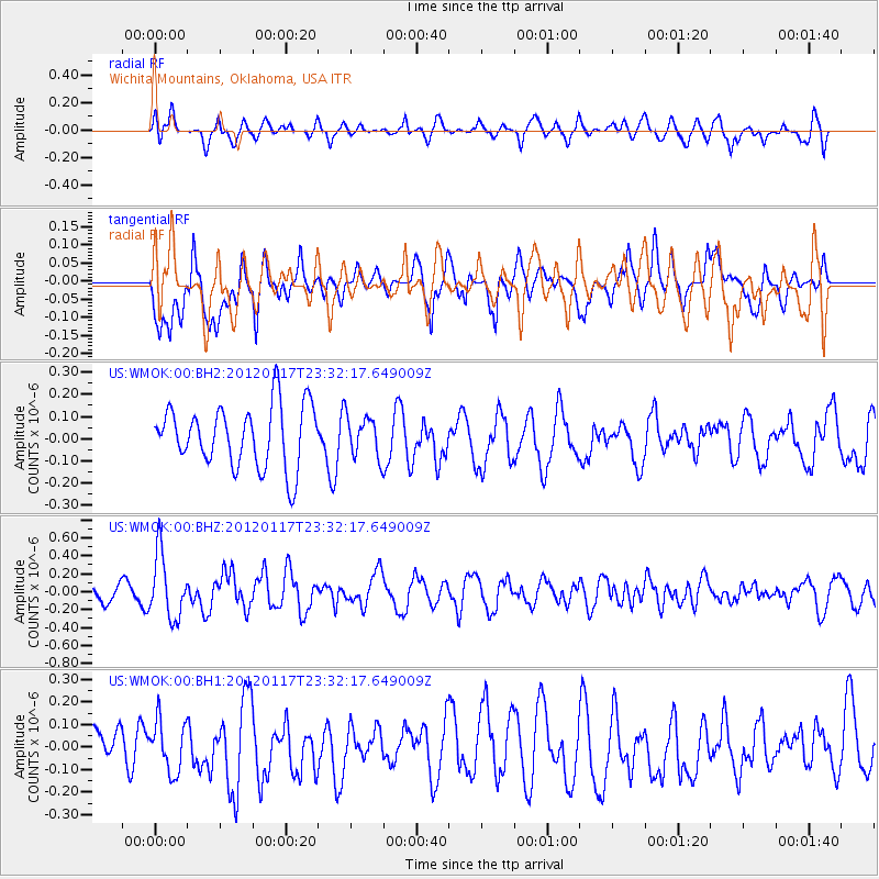
WMOK Wichita Mountains, Oklahoma, USA - Earthquake Result Viewer
*The percent match for this event was below the threshold and hence no stack was calculated.
| Earthquake location: |
Near Coast Of Central Chile |
| Earthquake latitude/longitude: |
-31.7/-71.5 |
| Earthquake time(UTC): |
2012/01/17 (017) 23:21:35 GMT |
| Earthquake Depth: |
33 km |
| Earthquake Magnitude: |
5.6 MW, 5.5 MB, 5.6 MW |
| Earthquake Catalog/Contributor: |
NEIC PDE/NEIC PDE-M |
|
| Network: |
US United States National Seismic Network |
| Station: |
WMOK Wichita Mountains, Oklahoma, USA |
| Lat/Lon: |
34.74 N/98.78 W |
| Elevation: |
486 m |
|
| Distance: |
70.9 deg |
| Az: |
336.447 deg |
| Baz: |
155.558 deg |
| Ray Param: |
$rayparam |
*The percent match for this event was below the threshold and hence was not used in the summary stack. |
|
| Radial Match: |
54.340176 % |
| Radial Bump: |
400 |
| Transverse Match: |
59.319736 % |
| Transverse Bump: |
400 |
| SOD ConfigId: |
558545 |
| Insert Time: |
2013-09-19 09:57:35.013 +0000 |
| GWidth: |
2.5 |
| Max Bumps: |
400 |
| Tol: |
0.001 |
|
Signal To Noise
| Channel | StoN | STA | LTA |
| US:WMOK:00:BHZ:20120117T23:32:17.649009Z | 2.4376056 | 3.5838175E-7 | 1.4702204E-7 |
| US:WMOK:00:BH1:20120117T23:32:17.649009Z | 1.3347156 | 1.1603531E-7 | 8.693636E-8 |
| US:WMOK:00:BH2:20120117T23:32:17.649009Z | 0.663852 | 9.2178745E-8 | 1.3885436E-7 |
| Arrivals |
| Ps | |
| PpPs | |
| PsPs/PpSs | |


