You are here: Home > Network List > US - United States National Seismic Network Stations List
> Station ERPA Erie, Pennsylvania, USA > Earthquake Result Viewer
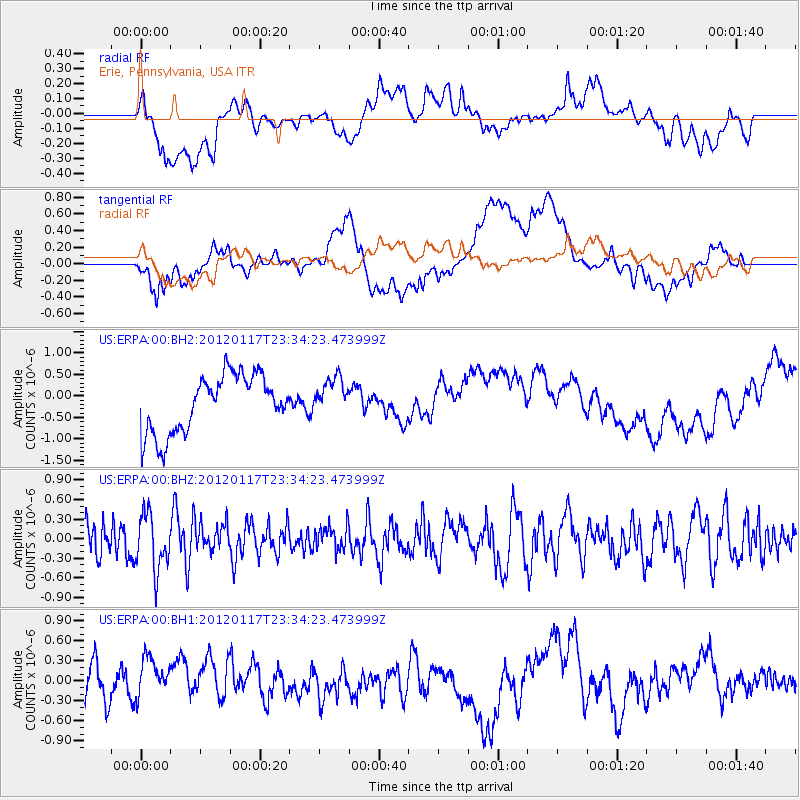
ERPA Erie, Pennsylvania, USA - Earthquake Result Viewer
*The percent match for this event was below the threshold and hence no stack was calculated.
| Earthquake location: |
Near Coast Of Central Chile |
| Earthquake latitude/longitude: |
-31.7/-71.6 |
| Earthquake time(UTC): |
2012/01/17 (017) 23:23:23 GMT |
| Earthquake Depth: |
34 km |
| Earthquake Magnitude: |
5.8 ML |
| Earthquake Catalog/Contributor: |
NEIC PDE/NEIC PDE-M |
|
| Network: |
US United States National Seismic Network |
| Station: |
ERPA Erie, Pennsylvania, USA |
| Lat/Lon: |
42.12 N/79.99 W |
| Elevation: |
306 m |
|
| Distance: |
73.9 deg |
| Az: |
353.524 deg |
| Baz: |
172.578 deg |
| Ray Param: |
$rayparam |
*The percent match for this event was below the threshold and hence was not used in the summary stack. |
|
| Radial Match: |
46.391994 % |
| Radial Bump: |
400 |
| Transverse Match: |
38.730873 % |
| Transverse Bump: |
400 |
| SOD ConfigId: |
558545 |
| Insert Time: |
2013-09-19 10:00:02.457 +0000 |
| GWidth: |
2.5 |
| Max Bumps: |
400 |
| Tol: |
0.001 |
|
Signal To Noise
| Channel | StoN | STA | LTA |
| US:ERPA:00:BHZ:20120117T23:34:23.473999Z | 1.2630692 | 4.304356E-7 | 3.4078545E-7 |
| US:ERPA:00:BH1:20120117T23:34:23.473999Z | 1.4172994 | 3.2373717E-7 | 2.2841834E-7 |
| US:ERPA:00:BH2:20120117T23:34:23.473999Z | 0.6689261 | 4.441421E-7 | 6.639629E-7 |
| Arrivals |
| Ps | |
| PpPs | |
| PsPs/PpSs | |


