You are here: Home > Network List > IU - Global Seismograph Network (GSN - IRIS/USGS) Stations List
> Station MAKZ Makanchi, Kazakhstan > Earthquake Result Viewer
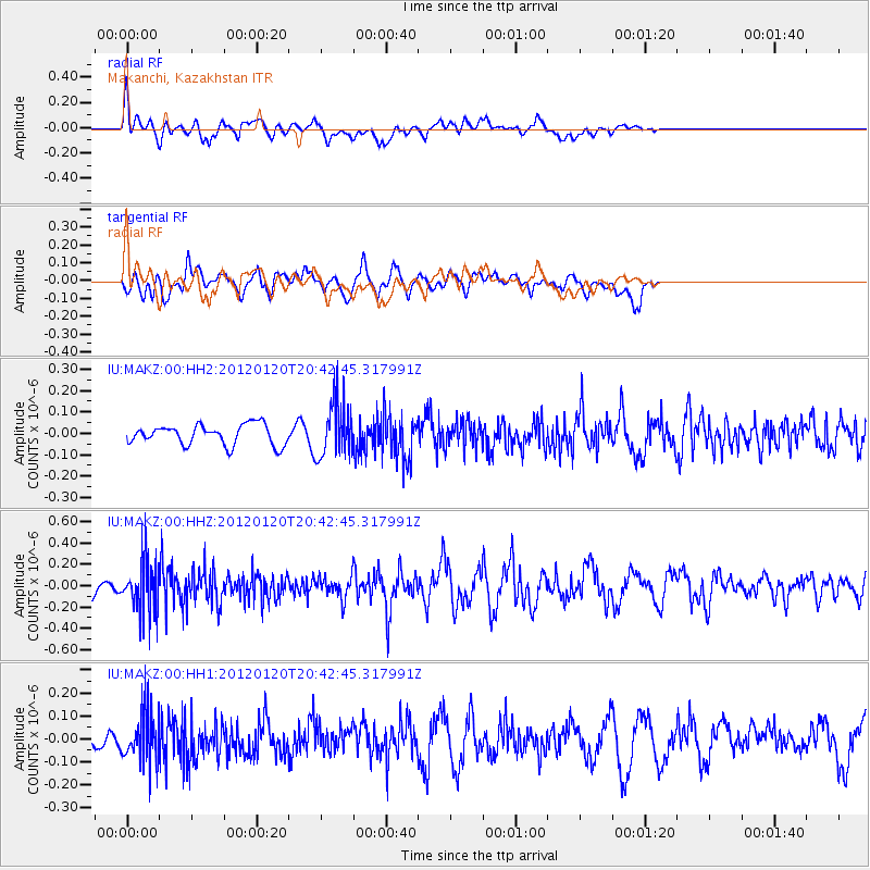
MAKZ Makanchi, Kazakhstan - Earthquake Result Viewer
*The percent match for this event was below the threshold and hence no stack was calculated.
| Earthquake location: |
Flores Region, Indonesia |
| Earthquake latitude/longitude: |
-8.4/119.7 |
| Earthquake time(UTC): |
2012/01/20 (020) 20:32:53 GMT |
| Earthquake Depth: |
126 km |
| Earthquake Magnitude: |
5.7 MB, 5.7 MW, 5.6 MW |
| Earthquake Catalog/Contributor: |
WHDF/NEIC |
|
| Network: |
IU Global Seismograph Network (GSN - IRIS/USGS) |
| Station: |
MAKZ Makanchi, Kazakhstan |
| Lat/Lon: |
46.81 N/81.98 E |
| Elevation: |
600 m |
|
| Distance: |
64.4 deg |
| Az: |
332.225 deg |
| Baz: |
137.837 deg |
| Ray Param: |
$rayparam |
*The percent match for this event was below the threshold and hence was not used in the summary stack. |
|
| Radial Match: |
61.598633 % |
| Radial Bump: |
400 |
| Transverse Match: |
64.783005 % |
| Transverse Bump: |
400 |
| SOD ConfigId: |
558545 |
| Insert Time: |
2013-09-19 10:09:40.331 +0000 |
| GWidth: |
2.5 |
| Max Bumps: |
400 |
| Tol: |
0.001 |
|
Signal To Noise
| Channel | StoN | STA | LTA |
| IU:MAKZ:00:HHZ:20120120T20:42:45.317991Z | 2.9889114 | 2.438037E-7 | 8.15694E-8 |
| IU:MAKZ:00:HH1:20120120T20:42:45.317991Z | 2.0463076 | 1.0853421E-7 | 5.3039056E-8 |
| IU:MAKZ:00:HH2:20120120T20:42:45.317991Z | 2.6910295 | 1.2810392E-7 | 4.7604054E-8 |
| Arrivals |
| Ps | |
| PpPs | |
| PsPs/PpSs | |


