OTAV Otavalo, Ecuador - Earthquake Result Viewer
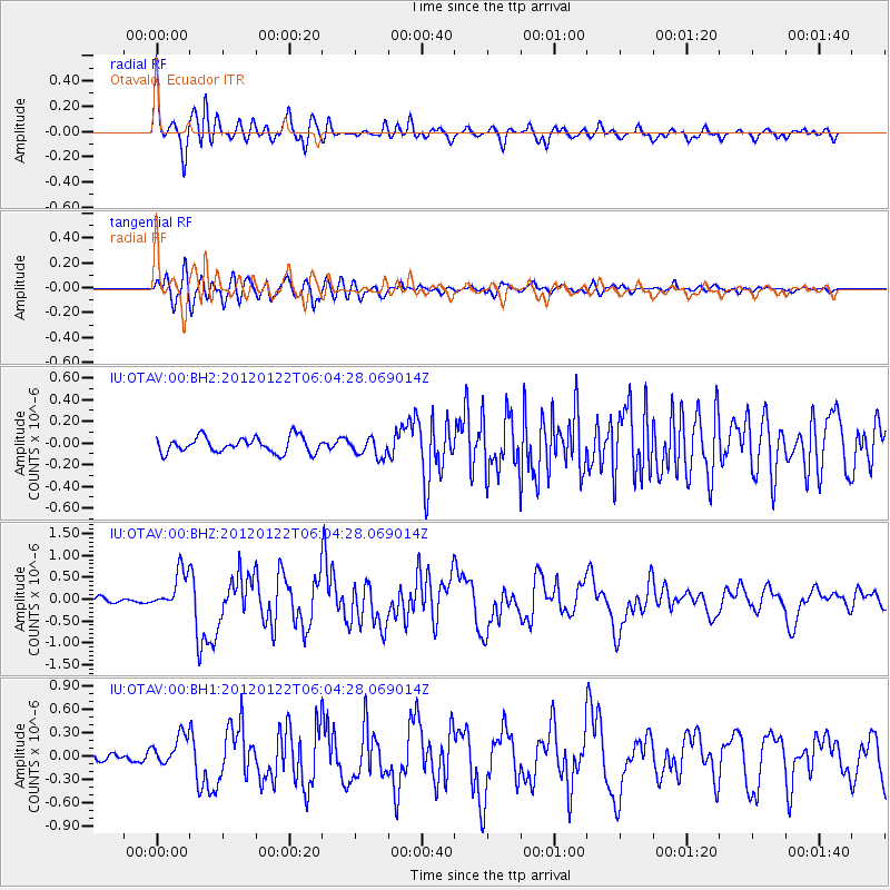
Earthquake location: South Sandwich Islands Region
Earthquake latitude/longitude: -56.8/-25.1
Earthquake time(UTC): 2012/01/22 (022) 05:53:42 GMT
Earthquake Depth: 13 km
Earthquake Magnitude: 5.5 MB, 6.1 MS, 6.0 MW, 6.0 MW
Earthquake Catalog/Contributor: WHDF/NEIC
Network: IU Global Seismograph Network (GSN - IRIS/USGS)
Station: OTAV Otavalo, Ecuador
Lat/Lon: 0.24 N/78.45 W
Elevation: 3510 m
Distance: 71.0 deg
Az: 302.001 deg
Baz: 152.157 deg
Ray Param: 0.054608226
Estimated Moho Depth: 64.25 km
Estimated Crust Vp/Vs: 1.72
Assumed Crust Vp: 6.472 km/s
Estimated Crust Vs: 3.757 km/s
Estimated Crust Poisson's Ratio: 0.25
Radial Match: 91.10714 %
Radial Bump: 400
Transverse Match: 82.499435 %
Transverse Bump: 400
SOD ConfigId: 558545
Insert Time: 2013-09-19 10:14:08.941 +0000
GWidth: 2.5
Max Bumps: 400
Tol: 0.001

Signal To Noise

ChannelStoNSTALTA
IU:OTAV:00:BHZ:20120122T06:04:28.069014Z5.7757194.4825356E-77.7610004E-8
IU:OTAV:00:BH1:20120122T06:04:28.069014Z3.56017041.9822134E-75.5677486E-8
IU:OTAV:00:BH2:20120122T06:04:28.069014Z1.21489858.7599105E-87.210405E-8
Arrivals
Ps7.4 SECOND
PpPs26 SECOND
PsPs/PpSs33 SECOND