You are here: Home > Network List > US - United States National Seismic Network Stations List
> Station WMOK Wichita Mountains, Oklahoma, USA > Earthquake Result Viewer
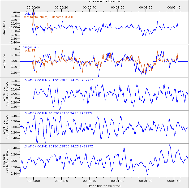
WMOK Wichita Mountains, Oklahoma, USA - Earthquake Result Viewer
*The percent match for this event was below the threshold and hence no stack was calculated.
| Earthquake location: |
Near East Coast Of Honshu, Japan |
| Earthquake latitude/longitude: |
40.2/142.2 |
| Earthquake time(UTC): |
2012/01/28 (028) 00:22:18 GMT |
| Earthquake Depth: |
55 km |
| Earthquake Magnitude: |
5.6 MW, 5.5 MW, 5.6 MB |
| Earthquake Catalog/Contributor: |
NEIC PDE/NEIC PDE-M |
|
| Network: |
US United States National Seismic Network |
| Station: |
WMOK Wichita Mountains, Oklahoma, USA |
| Lat/Lon: |
34.74 N/98.78 W |
| Elevation: |
486 m |
|
| Distance: |
86.6 deg |
| Az: |
46.177 deg |
| Baz: |
317.839 deg |
| Ray Param: |
$rayparam |
*The percent match for this event was below the threshold and hence was not used in the summary stack. |
|
| Radial Match: |
46.660942 % |
| Radial Bump: |
400 |
| Transverse Match: |
31.610777 % |
| Transverse Bump: |
400 |
| SOD ConfigId: |
558545 |
| Insert Time: |
2013-09-19 10:33:57.865 +0000 |
| GWidth: |
2.5 |
| Max Bumps: |
400 |
| Tol: |
0.001 |
|
Signal To Noise
| Channel | StoN | STA | LTA |
| US:WMOK:00:BHZ:20120128T00:34:25.348997Z | 1.9325894 | 3.053275E-7 | 1.5798881E-7 |
| US:WMOK:00:BH1:20120128T00:34:25.348997Z | 0.49574688 | 8.8004555E-8 | 1.7751913E-7 |
| US:WMOK:00:BH2:20120128T00:34:25.348997Z | 0.5438724 | 7.355922E-8 | 1.3525087E-7 |
| Arrivals |
| Ps | |
| PpPs | |
| PsPs/PpSs | |


