You are here: Home > Network List > US - United States National Seismic Network Stations List
> Station MSO Missoula, Montana, USA > Earthquake Result Viewer
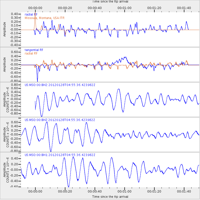
MSO Missoula, Montana, USA - Earthquake Result Viewer
*The percent match for this event was below the threshold and hence no stack was calculated.
| Earthquake location: |
Southern East Pacific Rise |
| Earthquake latitude/longitude: |
-36.8/-110.5 |
| Earthquake time(UTC): |
2012/01/28 (028) 04:43:41 GMT |
| Earthquake Depth: |
10 km |
| Earthquake Magnitude: |
5.6 MW, 5.6 MW |
| Earthquake Catalog/Contributor: |
NEIC PDE/NEIC PDE-M |
|
| Network: |
US United States National Seismic Network |
| Station: |
MSO Missoula, Montana, USA |
| Lat/Lon: |
46.83 N/113.94 W |
| Elevation: |
1264 m |
|
| Distance: |
83.3 deg |
| Az: |
357.634 deg |
| Baz: |
177.234 deg |
| Ray Param: |
$rayparam |
*The percent match for this event was below the threshold and hence was not used in the summary stack. |
|
| Radial Match: |
70.97664 % |
| Radial Bump: |
400 |
| Transverse Match: |
65.76687 % |
| Transverse Bump: |
400 |
| SOD ConfigId: |
558545 |
| Insert Time: |
2013-09-19 10:37:15.470 +0000 |
| GWidth: |
2.5 |
| Max Bumps: |
400 |
| Tol: |
0.001 |
|
Signal To Noise
| Channel | StoN | STA | LTA |
| US:MSO:00:BHZ:20120128T04:55:36.423982Z | 1.5255975 | 2.6680559E-7 | 1.7488597E-7 |
| US:MSO:00:BH1:20120128T04:55:36.423982Z | 0.5984951 | 1.0115966E-7 | 1.6902337E-7 |
| US:MSO:00:BH2:20120128T04:55:36.423982Z | 0.80648094 | 2.6325748E-7 | 3.264274E-7 |
| Arrivals |
| Ps | |
| PpPs | |
| PsPs/PpSs | |


