You are here: Home > Network List > US - United States National Seismic Network Stations List
> Station MNTX Cornudas Mountains, Texas, USA > Earthquake Result Viewer
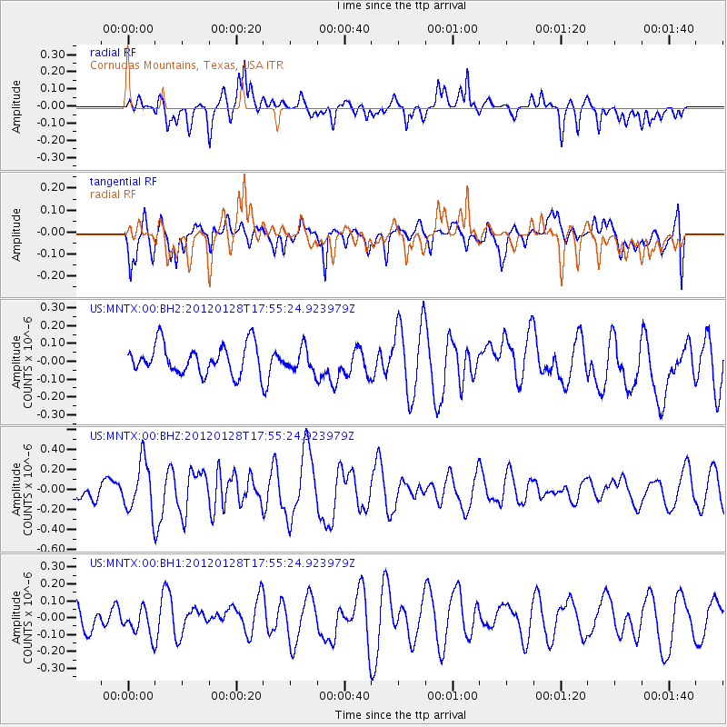
MNTX Cornudas Mountains, Texas, USA - Earthquake Result Viewer
*The percent match for this event was below the threshold and hence no stack was calculated.
| Earthquake location: |
Kermadec Islands, New Zealand |
| Earthquake latitude/longitude: |
-29.4/-177.4 |
| Earthquake time(UTC): |
2012/01/28 (028) 17:42:51 GMT |
| Earthquake Depth: |
21 km |
| Earthquake Magnitude: |
5.8 MB, 5.6 MS, 5.9 MW, 5.8 MW |
| Earthquake Catalog/Contributor: |
WHDF/NEIC |
|
| Network: |
US United States National Seismic Network |
| Station: |
MNTX Cornudas Mountains, Texas, USA |
| Lat/Lon: |
31.70 N/105.38 W |
| Elevation: |
404 m |
|
| Distance: |
91.5 deg |
| Az: |
54.191 deg |
| Baz: |
236.095 deg |
| Ray Param: |
$rayparam |
*The percent match for this event was below the threshold and hence was not used in the summary stack. |
|
| Radial Match: |
49.329212 % |
| Radial Bump: |
400 |
| Transverse Match: |
44.11771 % |
| Transverse Bump: |
400 |
| SOD ConfigId: |
558545 |
| Insert Time: |
2013-09-19 10:39:48.334 +0000 |
| GWidth: |
2.5 |
| Max Bumps: |
400 |
| Tol: |
0.001 |
|
Signal To Noise
| Channel | StoN | STA | LTA |
| US:MNTX:00:BHZ:20120128T17:55:24.923979Z | 2.2952504 | 2.5761787E-7 | 1.1223954E-7 |
| US:MNTX:00:BH1:20120128T17:55:24.923979Z | 1.0694728 | 8.158519E-8 | 7.628544E-8 |
| US:MNTX:00:BH2:20120128T17:55:24.923979Z | 0.79199326 | 6.462688E-8 | 8.160029E-8 |
| Arrivals |
| Ps | |
| PpPs | |
| PsPs/PpSs | |


