You are here: Home > Network List > US - United States National Seismic Network Stations List
> Station WMOK Wichita Mountains, Oklahoma, USA > Earthquake Result Viewer
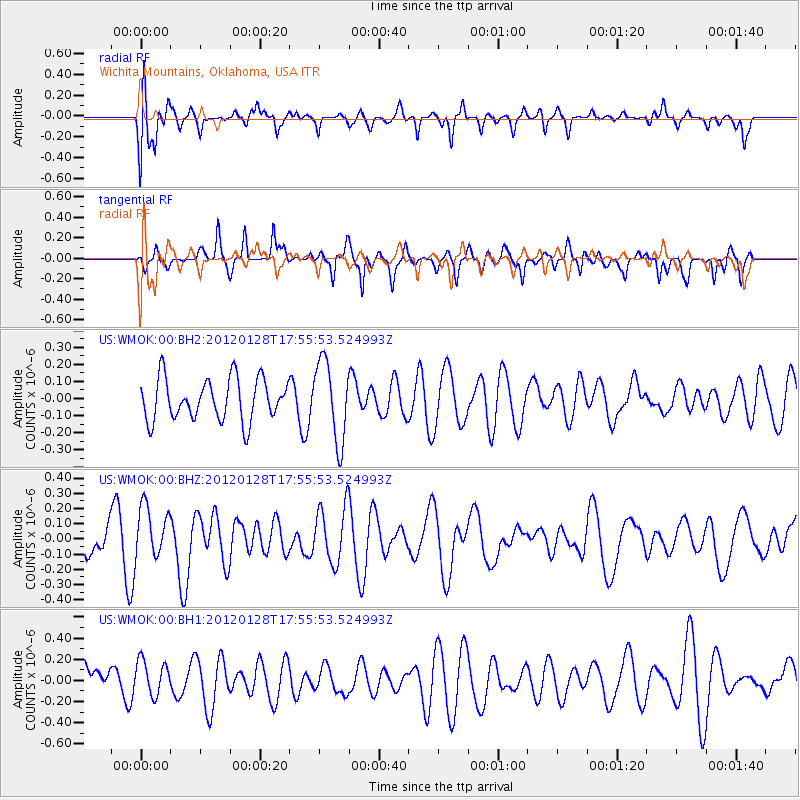
WMOK Wichita Mountains, Oklahoma, USA - Earthquake Result Viewer
*The percent match for this event was below the threshold and hence no stack was calculated.
| Earthquake location: |
Kermadec Islands, New Zealand |
| Earthquake latitude/longitude: |
-29.4/-177.4 |
| Earthquake time(UTC): |
2012/01/28 (028) 17:42:51 GMT |
| Earthquake Depth: |
21 km |
| Earthquake Magnitude: |
5.8 MB, 5.6 MS, 5.9 MW, 5.8 MW |
| Earthquake Catalog/Contributor: |
WHDF/NEIC |
|
| Network: |
US United States National Seismic Network |
| Station: |
WMOK Wichita Mountains, Oklahoma, USA |
| Lat/Lon: |
34.74 N/98.78 W |
| Elevation: |
486 m |
|
| Distance: |
97.8 deg |
| Az: |
54.569 deg |
| Baz: |
239.668 deg |
| Ray Param: |
$rayparam |
*The percent match for this event was below the threshold and hence was not used in the summary stack. |
|
| Radial Match: |
52.95806 % |
| Radial Bump: |
400 |
| Transverse Match: |
61.293182 % |
| Transverse Bump: |
347 |
| SOD ConfigId: |
558545 |
| Insert Time: |
2013-09-19 10:40:00.125 +0000 |
| GWidth: |
2.5 |
| Max Bumps: |
400 |
| Tol: |
0.001 |
|
Signal To Noise
| Channel | StoN | STA | LTA |
| US:WMOK:00:BHZ:20120128T17:55:53.524993Z | 2.0061295 | 1.7117478E-7 | 8.532588E-8 |
| US:WMOK:00:BH1:20120128T17:55:53.524993Z | 1.1915411 | 1.6609943E-7 | 1.3939884E-7 |
| US:WMOK:00:BH2:20120128T17:55:53.524993Z | 1.9210708 | 2.3333662E-7 | 1.2146175E-7 |
| Arrivals |
| Ps | |
| PpPs | |
| PsPs/PpSs | |


