You are here: Home > Network List > US - United States National Seismic Network Stations List
> Station BRAL Brewton, Alabama, USA > Earthquake Result Viewer
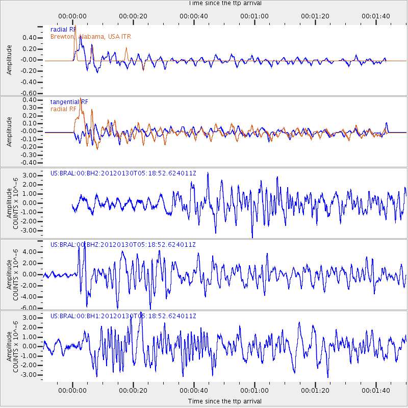
BRAL Brewton, Alabama, USA - Earthquake Result Viewer
*The percent match for this event was below the threshold and hence no stack was calculated.
| Earthquake location: |
Near Coast Of Peru |
| Earthquake latitude/longitude: |
-14.2/-75.6 |
| Earthquake time(UTC): |
2012/01/30 (030) 05:11:00 GMT |
| Earthquake Depth: |
43 km |
| Earthquake Magnitude: |
6.3 MB, 5.9 MS, 6.4 MW, 6.4 MW |
| Earthquake Catalog/Contributor: |
WHDF/NEIC |
|
| Network: |
US United States National Seismic Network |
| Station: |
BRAL Brewton, Alabama, USA |
| Lat/Lon: |
31.01 N/87.06 W |
| Elevation: |
61 m |
|
| Distance: |
46.2 deg |
| Az: |
346.384 deg |
| Baz: |
164.577 deg |
| Ray Param: |
$rayparam |
*The percent match for this event was below the threshold and hence was not used in the summary stack. |
|
| Radial Match: |
77.8085 % |
| Radial Bump: |
400 |
| Transverse Match: |
58.662903 % |
| Transverse Bump: |
400 |
| SOD ConfigId: |
558545 |
| Insert Time: |
2013-09-19 10:43:11.854 +0000 |
| GWidth: |
2.5 |
| Max Bumps: |
400 |
| Tol: |
0.001 |
|
Signal To Noise
| Channel | StoN | STA | LTA |
| US:BRAL:00:BHZ:20120130T05:18:52.624011Z | 10.397522 | 2.531051E-6 | 2.4342827E-7 |
| US:BRAL:00:BH1:20120130T05:18:52.624011Z | 1.0663621 | 6.071841E-7 | 5.693977E-7 |
| US:BRAL:00:BH2:20120130T05:18:52.624011Z | 1.8022506 | 8.1961434E-7 | 4.5477267E-7 |
| Arrivals |
| Ps | |
| PpPs | |
| PsPs/PpSs | |


