You are here: Home > Network List > US - United States National Seismic Network Stations List
> Station HAWA Hanford, Washington, USA > Earthquake Result Viewer
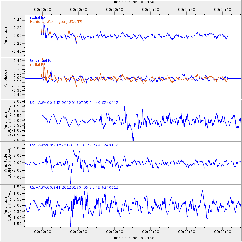
HAWA Hanford, Washington, USA - Earthquake Result Viewer
*The percent match for this event was below the threshold and hence no stack was calculated.
| Earthquake location: |
Near Coast Of Peru |
| Earthquake latitude/longitude: |
-14.2/-75.6 |
| Earthquake time(UTC): |
2012/01/30 (030) 05:11:00 GMT |
| Earthquake Depth: |
43 km |
| Earthquake Magnitude: |
6.3 MB, 5.9 MS, 6.4 MW, 6.4 MW |
| Earthquake Catalog/Contributor: |
WHDF/NEIC |
|
| Network: |
US United States National Seismic Network |
| Station: |
HAWA Hanford, Washington, USA |
| Lat/Lon: |
46.39 N/119.53 W |
| Elevation: |
364 m |
|
| Distance: |
72.0 deg |
| Az: |
329.704 deg |
| Baz: |
135.011 deg |
| Ray Param: |
$rayparam |
*The percent match for this event was below the threshold and hence was not used in the summary stack. |
|
| Radial Match: |
76.42629 % |
| Radial Bump: |
400 |
| Transverse Match: |
67.39754 % |
| Transverse Bump: |
400 |
| SOD ConfigId: |
558545 |
| Insert Time: |
2013-09-19 10:43:46.002 +0000 |
| GWidth: |
2.5 |
| Max Bumps: |
400 |
| Tol: |
0.001 |
|
Signal To Noise
| Channel | StoN | STA | LTA |
| US:HAWA:00:BHZ:20120130T05:21:49.624011Z | 4.2843137 | 8.3811597E-7 | 1.9562431E-7 |
| US:HAWA:00:BH1:20120130T05:21:49.624011Z | 1.0008537 | 3.0302743E-7 | 3.0276897E-7 |
| US:HAWA:00:BH2:20120130T05:21:49.624011Z | 1.2258112 | 3.765497E-7 | 3.0718408E-7 |
| Arrivals |
| Ps | |
| PpPs | |
| PsPs/PpSs | |


