You are here: Home > Network List > US - United States National Seismic Network Stations List
> Station HDIL Hopedale, Illinois, USA > Earthquake Result Viewer
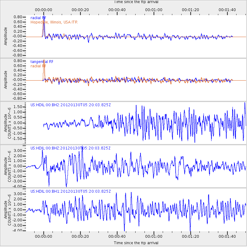
HDIL Hopedale, Illinois, USA - Earthquake Result Viewer
*The percent match for this event was below the threshold and hence no stack was calculated.
| Earthquake location: |
Near Coast Of Peru |
| Earthquake latitude/longitude: |
-14.2/-75.6 |
| Earthquake time(UTC): |
2012/01/30 (030) 05:11:00 GMT |
| Earthquake Depth: |
43 km |
| Earthquake Magnitude: |
6.3 MB, 5.9 MS, 6.4 MW, 6.4 MW |
| Earthquake Catalog/Contributor: |
WHDF/NEIC |
|
| Network: |
US United States National Seismic Network |
| Station: |
HDIL Hopedale, Illinois, USA |
| Lat/Lon: |
40.56 N/89.29 W |
| Elevation: |
219 m |
|
| Distance: |
55.9 deg |
| Az: |
347.451 deg |
| Baz: |
163.942 deg |
| Ray Param: |
$rayparam |
*The percent match for this event was below the threshold and hence was not used in the summary stack. |
|
| Radial Match: |
79.46963 % |
| Radial Bump: |
400 |
| Transverse Match: |
65.069695 % |
| Transverse Bump: |
400 |
| SOD ConfigId: |
558545 |
| Insert Time: |
2013-09-19 10:43:49.269 +0000 |
| GWidth: |
2.5 |
| Max Bumps: |
400 |
| Tol: |
0.001 |
|
Signal To Noise
| Channel | StoN | STA | LTA |
| US:HDIL:00:BHZ:20120130T05:20:03.825Z | 10.395401 | 1.5658197E-6 | 1.5062619E-7 |
| US:HDIL:00:BH1:20120130T05:20:03.825Z | 4.23744 | 1.1022382E-6 | 2.601189E-7 |
| US:HDIL:00:BH2:20120130T05:20:03.825Z | 2.0854461 | 3.9315913E-7 | 1.8852519E-7 |
| Arrivals |
| Ps | |
| PpPs | |
| PsPs/PpSs | |


