You are here: Home > Network List > US - United States National Seismic Network Stations List
> Station VBMS Vicksburg, Mississippi > Earthquake Result Viewer
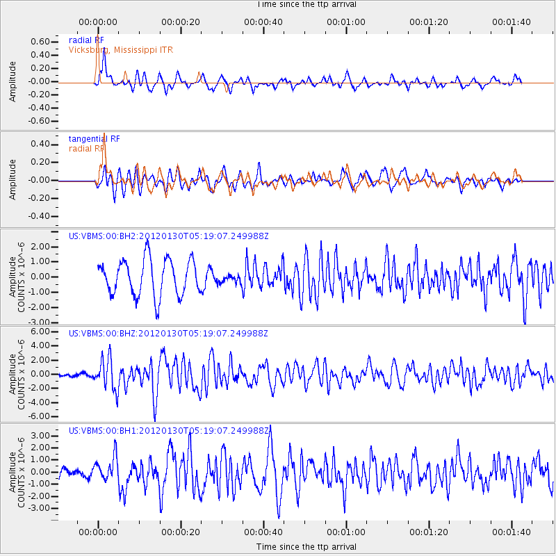
VBMS Vicksburg, Mississippi - Earthquake Result Viewer
*The percent match for this event was below the threshold and hence no stack was calculated.
| Earthquake location: |
Near Coast Of Peru |
| Earthquake latitude/longitude: |
-14.2/-75.6 |
| Earthquake time(UTC): |
2012/01/30 (030) 05:11:00 GMT |
| Earthquake Depth: |
43 km |
| Earthquake Magnitude: |
6.3 MB, 5.9 MS, 6.4 MW, 6.4 MW |
| Earthquake Catalog/Contributor: |
WHDF/NEIC |
|
| Network: |
US United States National Seismic Network |
| Station: |
VBMS Vicksburg, Mississippi |
| Lat/Lon: |
32.22 N/90.52 W |
| Elevation: |
0.0 m |
|
| Distance: |
48.3 deg |
| Az: |
343.041 deg |
| Baz: |
160.501 deg |
| Ray Param: |
$rayparam |
*The percent match for this event was below the threshold and hence was not used in the summary stack. |
|
| Radial Match: |
70.14208 % |
| Radial Bump: |
377 |
| Transverse Match: |
52.34762 % |
| Transverse Bump: |
390 |
| SOD ConfigId: |
558545 |
| Insert Time: |
2013-09-19 10:45:11.655 +0000 |
| GWidth: |
2.5 |
| Max Bumps: |
400 |
| Tol: |
0.001 |
|
Signal To Noise
| Channel | StoN | STA | LTA |
| US:VBMS:00:BHZ:20120130T05:19:07.249988Z | 8.687332 | 2.2373058E-6 | 2.5753658E-7 |
| US:VBMS:00:BH1:20120130T05:19:07.249988Z | 1.411721 | 9.903366E-7 | 7.0151015E-7 |
| US:VBMS:00:BH2:20120130T05:19:07.249988Z | 0.23635042 | 2.7986016E-7 | 1.1840899E-6 |
| Arrivals |
| Ps | |
| PpPs | |
| PsPs/PpSs | |


