You are here: Home > Network List > US - United States National Seismic Network Stations List
> Station HAWA Hanford, Washington, USA > Earthquake Result Viewer
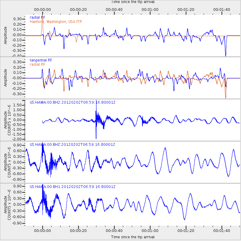
HAWA Hanford, Washington, USA - Earthquake Result Viewer
*The percent match for this event was below the threshold and hence no stack was calculated.
| Earthquake location: |
New Britain Region, P.N.G. |
| Earthquake latitude/longitude: |
-6.6/149.8 |
| Earthquake time(UTC): |
2012/02/02 (033) 06:46:30 GMT |
| Earthquake Depth: |
51 km |
| Earthquake Magnitude: |
5.6 MW |
| Earthquake Catalog/Contributor: |
NEIC PDE/NEIC PDE-M |
|
| Network: |
US United States National Seismic Network |
| Station: |
HAWA Hanford, Washington, USA |
| Lat/Lon: |
46.39 N/119.53 W |
| Elevation: |
364 m |
|
| Distance: |
95.2 deg |
| Az: |
44.021 deg |
| Baz: |
265.975 deg |
| Ray Param: |
$rayparam |
*The percent match for this event was below the threshold and hence was not used in the summary stack. |
|
| Radial Match: |
49.14811 % |
| Radial Bump: |
400 |
| Transverse Match: |
56.305386 % |
| Transverse Bump: |
383 |
| SOD ConfigId: |
558545 |
| Insert Time: |
2013-09-19 10:48:28.142 +0000 |
| GWidth: |
2.5 |
| Max Bumps: |
400 |
| Tol: |
0.001 |
|
Signal To Noise
| Channel | StoN | STA | LTA |
| US:HAWA:00:BHZ:20120202T06:59:16.80001Z | 1.2405251 | 4.4182607E-7 | 3.5616054E-7 |
| US:HAWA:00:BH1:20120202T06:59:16.80001Z | 1.865541 | 3.5970288E-7 | 1.9281426E-7 |
| US:HAWA:00:BH2:20120202T06:59:16.80001Z | 4.097004 | 4.80444E-7 | 1.17267156E-7 |
| Arrivals |
| Ps | |
| PpPs | |
| PsPs/PpSs | |


