You are here: Home > Network List > US - United States National Seismic Network Stations List
> Station WRAK Wrangell Island, Southeastern Alaska, Alaska, USA > Earthquake Result Viewer
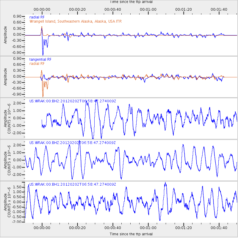
WRAK Wrangell Island, Southeastern Alaska, Alaska, USA - Earthquake Result Viewer
*The percent match for this event was below the threshold and hence no stack was calculated.
| Earthquake location: |
New Britain Region, P.N.G. |
| Earthquake latitude/longitude: |
-6.6/149.8 |
| Earthquake time(UTC): |
2012/02/02 (033) 06:46:30 GMT |
| Earthquake Depth: |
51 km |
| Earthquake Magnitude: |
5.6 MW |
| Earthquake Catalog/Contributor: |
NEIC PDE/NEIC PDE-M |
|
| Network: |
US United States National Seismic Network |
| Station: |
WRAK Wrangell Island, Southeastern Alaska, Alaska, USA |
| Lat/Lon: |
56.42 N/132.35 W |
| Elevation: |
81 m |
|
| Distance: |
88.8 deg |
| Az: |
32.918 deg |
| Baz: |
256.315 deg |
| Ray Param: |
$rayparam |
*The percent match for this event was below the threshold and hence was not used in the summary stack. |
|
| Radial Match: |
72.80943 % |
| Radial Bump: |
400 |
| Transverse Match: |
44.93852 % |
| Transverse Bump: |
400 |
| SOD ConfigId: |
558545 |
| Insert Time: |
2013-09-19 10:48:33.131 +0000 |
| GWidth: |
2.5 |
| Max Bumps: |
400 |
| Tol: |
0.001 |
|
Signal To Noise
| Channel | StoN | STA | LTA |
| US:WRAK:00:BHZ:20120202T06:58:47.274009Z | 0.9595406 | 1.2919129E-6 | 1.3463869E-6 |
| US:WRAK:00:BH1:20120202T06:58:47.274009Z | 0.5783146 | 6.714795E-7 | 1.1610972E-6 |
| US:WRAK:00:BH2:20120202T06:58:47.274009Z | 2.0125005 | 1.7491615E-6 | 8.691483E-7 |
| Arrivals |
| Ps | |
| PpPs | |
| PsPs/PpSs | |


