You are here: Home > Network List > IU - Global Seismograph Network (GSN - IRIS/USGS) Stations List
> Station JOHN Johnston Island, USA > Earthquake Result Viewer
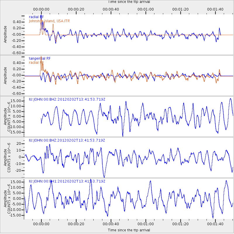
JOHN Johnston Island, USA - Earthquake Result Viewer
*The percent match for this event was below the threshold and hence no stack was calculated.
| Earthquake location: |
Vanuatu Islands |
| Earthquake latitude/longitude: |
-17.8/167.1 |
| Earthquake time(UTC): |
2012/02/02 (033) 13:34:40 GMT |
| Earthquake Depth: |
23 km |
| Earthquake Magnitude: |
6.5 MB, 6.9 MS, 7.1 MW, 7.1 MW |
| Earthquake Catalog/Contributor: |
WHDF/NEIC |
|
| Network: |
IU Global Seismograph Network (GSN - IRIS/USGS) |
| Station: |
JOHN Johnston Island, USA |
| Lat/Lon: |
16.73 N/169.53 W |
| Elevation: |
2.0 m |
|
| Distance: |
41.3 deg |
| Az: |
35.091 deg |
| Baz: |
214.856 deg |
| Ray Param: |
$rayparam |
*The percent match for this event was below the threshold and hence was not used in the summary stack. |
|
| Radial Match: |
62.183613 % |
| Radial Bump: |
400 |
| Transverse Match: |
45.564598 % |
| Transverse Bump: |
400 |
| SOD ConfigId: |
558545 |
| Insert Time: |
2013-09-19 10:52:55.682 +0000 |
| GWidth: |
2.5 |
| Max Bumps: |
400 |
| Tol: |
0.001 |
|
Signal To Noise
| Channel | StoN | STA | LTA |
| IU:JOHN:00:BHZ:20120202T13:41:53.719Z | 5.7697444 | 1.2009922E-5 | 2.0815346E-6 |
| IU:JOHN:00:BH1:20120202T13:41:53.719Z | 1.3344443 | 7.1102854E-6 | 5.3282743E-6 |
| IU:JOHN:00:BH2:20120202T13:41:53.719Z | 1.7205764 | 9.493574E-6 | 5.5176706E-6 |
| Arrivals |
| Ps | |
| PpPs | |
| PsPs/PpSs | |


