You are here: Home > Network List > CN - Canadian National Seismograph Network Stations List
> Station LLLB LILLOOET, BC, CANADA ADA > Earthquake Result Viewer
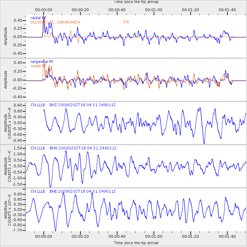
LLLB LILLOOET, BC, CANADA ADA - Earthquake Result Viewer
*The percent match for this event was below the threshold and hence no stack was calculated.
| Earthquake location: |
Near Coast Of Peru |
| Earthquake latitude/longitude: |
-13.6/-76.6 |
| Earthquake time(UTC): |
2009/02/02 (033) 17:53:21 GMT |
| Earthquake Depth: |
21 km |
| Earthquake Magnitude: |
5.6 MB, 5.6 MS, 6.0 MW, 5.9 MW |
| Earthquake Catalog/Contributor: |
WHDF/NEIC |
|
| Network: |
CN Canadian National Seismograph Network |
| Station: |
LLLB LILLOOET, BC, CANADA ADA |
| Lat/Lon: |
50.61 N/121.88 W |
| Elevation: |
700 m |
|
| Distance: |
75.2 deg |
| Az: |
332.053 deg |
| Baz: |
134.337 deg |
| Ray Param: |
$rayparam |
*The percent match for this event was below the threshold and hence was not used in the summary stack. |
|
| Radial Match: |
61.494957 % |
| Radial Bump: |
400 |
| Transverse Match: |
60.22635 % |
| Transverse Bump: |
332 |
| SOD ConfigId: |
2658 |
| Insert Time: |
2010-02-27 06:41:03.594 +0000 |
| GWidth: |
2.5 |
| Max Bumps: |
400 |
| Tol: |
0.001 |
|
Signal To Noise
| Channel | StoN | STA | LTA |
| CN:LLLB: :BHN:20090202T18:04:31.349011Z | 3.2346928 | 9.420139E-7 | 2.9122208E-7 |
| CN:LLLB: :BHE:20090202T18:04:31.349011Z | 0.49461734 | 2.6736024E-7 | 5.4053953E-7 |
| CN:LLLB: :BHZ:20090202T18:04:31.349011Z | 0.73412097 | 2.4622295E-7 | 3.353983E-7 |
| Arrivals |
| Ps | |
| PpPs | |
| PsPs/PpSs | |


