You are here: Home > Network List > US - United States National Seismic Network Stations List
> Station HAWA Hanford, Washington, USA > Earthquake Result Viewer
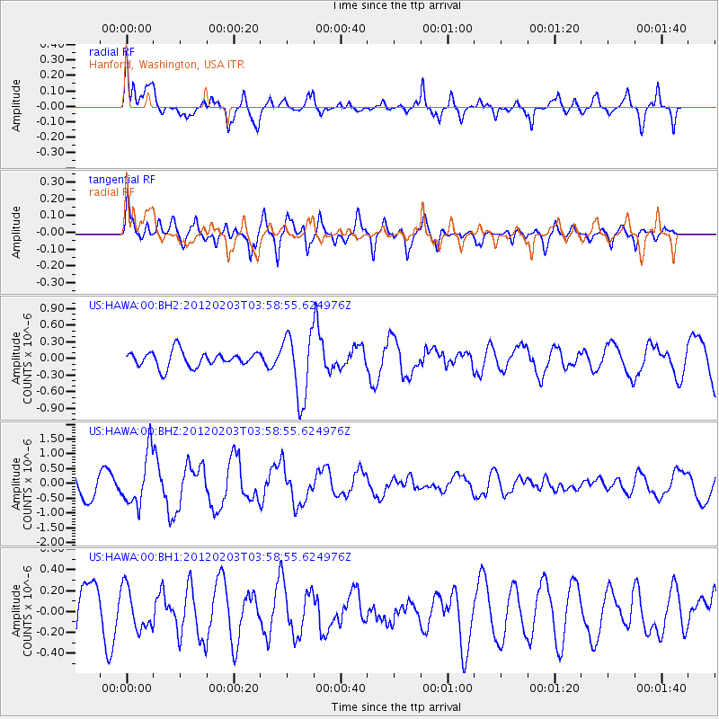
HAWA Hanford, Washington, USA - Earthquake Result Viewer
*The percent match for this event was below the threshold and hence no stack was calculated.
| Earthquake location: |
Vanuatu Islands |
| Earthquake latitude/longitude: |
-17.4/167.3 |
| Earthquake time(UTC): |
2012/02/03 (034) 03:46:21 GMT |
| Earthquake Depth: |
8.0 km |
| Earthquake Magnitude: |
5.9 MB, 5.8 MS, 6.1 MW, 6.1 MW |
| Earthquake Catalog/Contributor: |
WHDF/NEIC |
|
| Network: |
US United States National Seismic Network |
| Station: |
HAWA Hanford, Washington, USA |
| Lat/Lon: |
46.39 N/119.53 W |
| Elevation: |
364 m |
|
| Distance: |
91.3 deg |
| Az: |
41.509 deg |
| Baz: |
246.116 deg |
| Ray Param: |
$rayparam |
*The percent match for this event was below the threshold and hence was not used in the summary stack. |
|
| Radial Match: |
65.84392 % |
| Radial Bump: |
400 |
| Transverse Match: |
70.14155 % |
| Transverse Bump: |
400 |
| SOD ConfigId: |
558545 |
| Insert Time: |
2013-09-19 10:58:32.059 +0000 |
| GWidth: |
2.5 |
| Max Bumps: |
400 |
| Tol: |
0.001 |
|
Signal To Noise
| Channel | StoN | STA | LTA |
| US:HAWA:00:BHZ:20120203T03:58:55.624976Z | 2.4624157 | 8.910181E-7 | 3.6184713E-7 |
| US:HAWA:00:BH1:20120203T03:58:55.624976Z | 0.6718658 | 1.9975629E-7 | 2.9731572E-7 |
| US:HAWA:00:BH2:20120203T03:58:55.624976Z | 4.2834086 | 5.961373E-7 | 1.3917357E-7 |
| Arrivals |
| Ps | |
| PpPs | |
| PsPs/PpSs | |


