You are here: Home > Network List > US - United States National Seismic Network Stations List
> Station AMTX Amarillo, Texas, USA > Earthquake Result Viewer
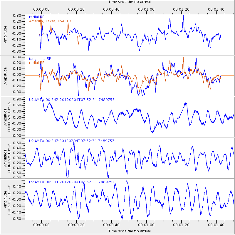
AMTX Amarillo, Texas, USA - Earthquake Result Viewer
*The percent match for this event was below the threshold and hence no stack was calculated.
| Earthquake location: |
Tonga Islands |
| Earthquake latitude/longitude: |
-20.5/-174.0 |
| Earthquake time(UTC): |
2012/02/04 (035) 07:40:12 GMT |
| Earthquake Depth: |
8.0 km |
| Earthquake Magnitude: |
5.5 MB, 5.5 MS, 5.8 MW, 5.7 MW |
| Earthquake Catalog/Contributor: |
WHDF/NEIC |
|
| Network: |
US United States National Seismic Network |
| Station: |
AMTX Amarillo, Texas, USA |
| Lat/Lon: |
34.53 N/101.41 W |
| Elevation: |
1010 m |
|
| Distance: |
88.0 deg |
| Az: |
52.036 deg |
| Baz: |
243.507 deg |
| Ray Param: |
$rayparam |
*The percent match for this event was below the threshold and hence was not used in the summary stack. |
|
| Radial Match: |
42.375412 % |
| Radial Bump: |
400 |
| Transverse Match: |
39.460655 % |
| Transverse Bump: |
400 |
| SOD ConfigId: |
558545 |
| Insert Time: |
2013-09-19 11:05:10.360 +0000 |
| GWidth: |
2.5 |
| Max Bumps: |
400 |
| Tol: |
0.001 |
|
Signal To Noise
| Channel | StoN | STA | LTA |
| US:AMTX:00:BHZ:20120204T07:52:31.748975Z | 0.8301232 | 1.5808597E-7 | 1.9043675E-7 |
| US:AMTX:00:BH1:20120204T07:52:31.748975Z | 1.061038 | 2.3237337E-7 | 2.1900567E-7 |
| US:AMTX:00:BH2:20120204T07:52:31.748975Z | 0.97930455 | 3.451319E-7 | 3.524255E-7 |
| Arrivals |
| Ps | |
| PpPs | |
| PsPs/PpSs | |


