You are here: Home > Network List > US - United States National Seismic Network Stations List
> Station WMOK Wichita Mountains, Oklahoma, USA > Earthquake Result Viewer
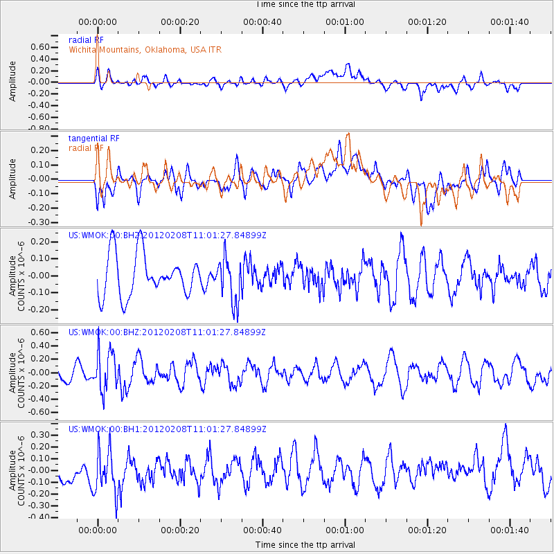
WMOK Wichita Mountains, Oklahoma, USA - Earthquake Result Viewer
*The percent match for this event was below the threshold and hence no stack was calculated.
| Earthquake location: |
Near Coast Of Ecuador |
| Earthquake latitude/longitude: |
0.7/-79.3 |
| Earthquake time(UTC): |
2012/02/08 (039) 10:54:42 GMT |
| Earthquake Depth: |
64 km |
| Earthquake Magnitude: |
5.6 MB, 5.6 ML |
| Earthquake Catalog/Contributor: |
NEIC PDE/NEIC PDE-M |
|
| Network: |
US United States National Seismic Network |
| Station: |
WMOK Wichita Mountains, Oklahoma, USA |
| Lat/Lon: |
34.74 N/98.78 W |
| Elevation: |
486 m |
|
| Distance: |
38.5 deg |
| Az: |
333.76 deg |
| Baz: |
147.533 deg |
| Ray Param: |
$rayparam |
*The percent match for this event was below the threshold and hence was not used in the summary stack. |
|
| Radial Match: |
52.319824 % |
| Radial Bump: |
400 |
| Transverse Match: |
48.463776 % |
| Transverse Bump: |
400 |
| SOD ConfigId: |
558545 |
| Insert Time: |
2013-09-19 11:27:02.693 +0000 |
| GWidth: |
2.5 |
| Max Bumps: |
400 |
| Tol: |
0.001 |
|
Signal To Noise
| Channel | StoN | STA | LTA |
| US:WMOK:00:BHZ:20120208T11:01:27.84899Z | 2.7354465 | 3.0161144E-7 | 1.10260416E-7 |
| US:WMOK:00:BH1:20120208T11:01:27.84899Z | 1.4967686 | 2.0906681E-7 | 1.3967879E-7 |
| US:WMOK:00:BH2:20120208T11:01:27.84899Z | 1.0744867 | 1.3272218E-7 | 1.2352147E-7 |
| Arrivals |
| Ps | |
| PpPs | |
| PsPs/PpSs | |


