You are here: Home > Network List > II - Global Seismograph Network (GSN - IRIS/IDA) Stations List
> Station WRAB Tennant Creek, NT, Australia > Earthquake Result Viewer
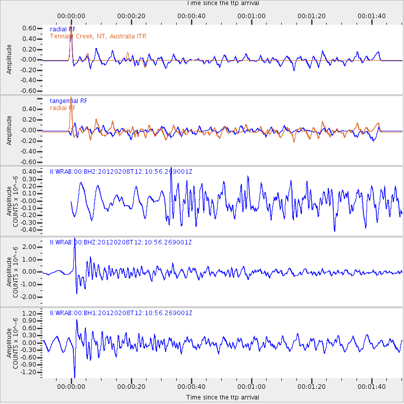
WRAB Tennant Creek, NT, Australia - Earthquake Result Viewer
*The percent match for this event was below the threshold and hence no stack was calculated.
| Earthquake location: |
Near West Coast Of Honshu, Japan |
| Earthquake latitude/longitude: |
37.9/138.0 |
| Earthquake time(UTC): |
2012/02/08 (039) 12:01:37 GMT |
| Earthquake Depth: |
10 km |
| Earthquake Magnitude: |
5.8 MB |
| Earthquake Catalog/Contributor: |
NEIC PDE/NEIC PDE-M |
|
| Network: |
II Global Seismograph Network (GSN - IRIS/IDA) |
| Station: |
WRAB Tennant Creek, NT, Australia |
| Lat/Lon: |
19.93 S/134.36 E |
| Elevation: |
366 m |
|
| Distance: |
57.6 deg |
| Az: |
184.056 deg |
| Baz: |
3.412 deg |
| Ray Param: |
$rayparam |
*The percent match for this event was below the threshold and hence was not used in the summary stack. |
|
| Radial Match: |
75.352776 % |
| Radial Bump: |
378 |
| Transverse Match: |
70.21338 % |
| Transverse Bump: |
400 |
| SOD ConfigId: |
558545 |
| Insert Time: |
2013-09-19 11:28:34.199 +0000 |
| GWidth: |
2.5 |
| Max Bumps: |
400 |
| Tol: |
0.001 |
|
Signal To Noise
| Channel | StoN | STA | LTA |
| II:WRAB:00:BHZ:20120208T12:10:56.269001Z | 7.368489 | 9.363063E-7 | 1.2706897E-7 |
| II:WRAB:00:BH1:20120208T12:10:56.269001Z | 4.4537644 | 4.8808437E-7 | 1.09589166E-7 |
| II:WRAB:00:BH2:20120208T12:10:56.269001Z | 1.4540397 | 1.8264184E-7 | 1.2560994E-7 |
| Arrivals |
| Ps | |
| PpPs | |
| PsPs/PpSs | |


