You are here: Home > Network List > US - United States National Seismic Network Stations List
> Station AGMN Agassiz National Wildlife Refuge, Minnesota, USA > Earthquake Result Viewer
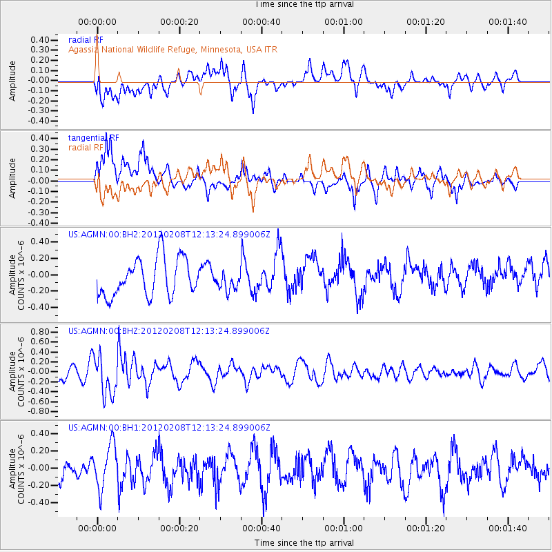
AGMN Agassiz National Wildlife Refuge, Minnesota, USA - Earthquake Result Viewer
*The percent match for this event was below the threshold and hence no stack was calculated.
| Earthquake location: |
Near West Coast Of Honshu, Japan |
| Earthquake latitude/longitude: |
37.9/138.0 |
| Earthquake time(UTC): |
2012/02/08 (039) 12:01:37 GMT |
| Earthquake Depth: |
10 km |
| Earthquake Magnitude: |
5.8 MB |
| Earthquake Catalog/Contributor: |
NEIC PDE/NEIC PDE-M |
|
| Network: |
US United States National Seismic Network |
| Station: |
AGMN Agassiz National Wildlife Refuge, Minnesota, USA |
| Lat/Lon: |
48.30 N/95.86 W |
| Elevation: |
351 m |
|
| Distance: |
81.8 deg |
| Az: |
33.017 deg |
| Baz: |
319.768 deg |
| Ray Param: |
$rayparam |
*The percent match for this event was below the threshold and hence was not used in the summary stack. |
|
| Radial Match: |
42.572006 % |
| Radial Bump: |
400 |
| Transverse Match: |
72.753426 % |
| Transverse Bump: |
400 |
| SOD ConfigId: |
558545 |
| Insert Time: |
2013-09-19 11:29:33.970 +0000 |
| GWidth: |
2.5 |
| Max Bumps: |
400 |
| Tol: |
0.001 |
|
Signal To Noise
| Channel | StoN | STA | LTA |
| US:AGMN:00:BHZ:20120208T12:13:24.899006Z | 2.4174087 | 3.975716E-7 | 1.6446188E-7 |
| US:AGMN:00:BH1:20120208T12:13:24.899006Z | 1.4632473 | 2.5992765E-7 | 1.7763753E-7 |
| US:AGMN:00:BH2:20120208T12:13:24.899006Z | 0.5123733 | 1.1800668E-7 | 2.3031386E-7 |
| Arrivals |
| Ps | |
| PpPs | |
| PsPs/PpSs | |


