You are here: Home > Network List > US - United States National Seismic Network Stations List
> Station MSO Missoula, Montana, USA > Earthquake Result Viewer
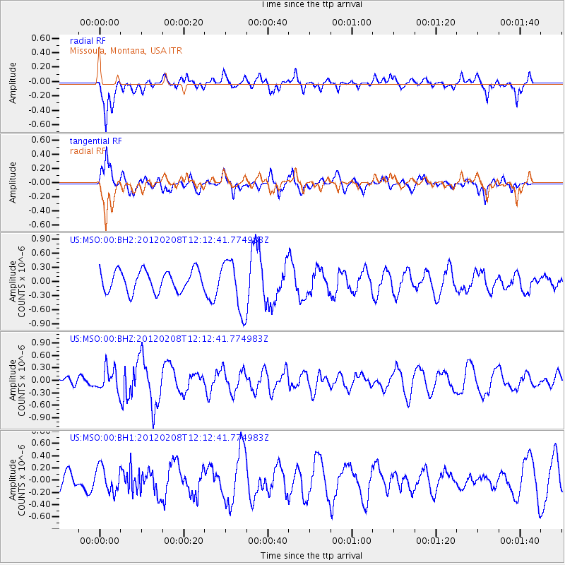
MSO Missoula, Montana, USA - Earthquake Result Viewer
*The percent match for this event was below the threshold and hence no stack was calculated.
| Earthquake location: |
Near West Coast Of Honshu, Japan |
| Earthquake latitude/longitude: |
37.9/138.0 |
| Earthquake time(UTC): |
2012/02/08 (039) 12:01:37 GMT |
| Earthquake Depth: |
10 km |
| Earthquake Magnitude: |
5.8 MB |
| Earthquake Catalog/Contributor: |
NEIC PDE/NEIC PDE-M |
|
| Network: |
US United States National Seismic Network |
| Station: |
MSO Missoula, Montana, USA |
| Lat/Lon: |
46.83 N/113.94 W |
| Elevation: |
1264 m |
|
| Distance: |
74.0 deg |
| Az: |
42.776 deg |
| Baz: |
308.473 deg |
| Ray Param: |
$rayparam |
*The percent match for this event was below the threshold and hence was not used in the summary stack. |
|
| Radial Match: |
74.985535 % |
| Radial Bump: |
400 |
| Transverse Match: |
56.22433 % |
| Transverse Bump: |
383 |
| SOD ConfigId: |
558545 |
| Insert Time: |
2013-09-19 11:30:30.771 +0000 |
| GWidth: |
2.5 |
| Max Bumps: |
400 |
| Tol: |
0.001 |
|
Signal To Noise
| Channel | StoN | STA | LTA |
| US:MSO:00:BHZ:20120208T12:12:41.774983Z | 1.7941061 | 2.730516E-7 | 1.5219366E-7 |
| US:MSO:00:BH1:20120208T12:12:41.774983Z | 0.9752649 | 2.085327E-7 | 2.138216E-7 |
| US:MSO:00:BH2:20120208T12:12:41.774983Z | 2.5291882 | 5.6298813E-7 | 2.2259637E-7 |
| Arrivals |
| Ps | |
| PpPs | |
| PsPs/PpSs | |


