You are here: Home > Network List > IU - Global Seismograph Network (GSN - IRIS/USGS) Stations List
> Station PMG Port Moresby, New Guinea > Earthquake Result Viewer
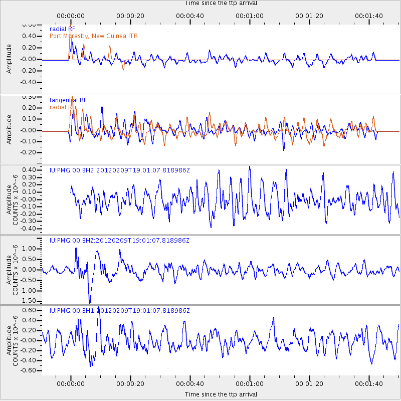
PMG Port Moresby, New Guinea - Earthquake Result Viewer
*The percent match for this event was below the threshold and hence no stack was calculated.
| Earthquake location: |
Macquarie Island Region |
| Earthquake latitude/longitude: |
-58.3/157.8 |
| Earthquake time(UTC): |
2012/02/09 (040) 18:52:48 GMT |
| Earthquake Depth: |
10 km |
| Earthquake Magnitude: |
5.6 MB, 5.4 MS, 5.9 MW, 5.8 MW |
| Earthquake Catalog/Contributor: |
WHDF/NEIC |
|
| Network: |
IU Global Seismograph Network (GSN - IRIS/USGS) |
| Station: |
PMG Port Moresby, New Guinea |
| Lat/Lon: |
9.40 S/147.16 E |
| Elevation: |
90 m |
|
| Distance: |
49.5 deg |
| Az: |
346.084 deg |
| Baz: |
172.608 deg |
| Ray Param: |
$rayparam |
*The percent match for this event was below the threshold and hence was not used in the summary stack. |
|
| Radial Match: |
70.86329 % |
| Radial Bump: |
400 |
| Transverse Match: |
65.81268 % |
| Transverse Bump: |
400 |
| SOD ConfigId: |
558545 |
| Insert Time: |
2013-09-19 11:33:15.712 +0000 |
| GWidth: |
2.5 |
| Max Bumps: |
400 |
| Tol: |
0.001 |
|
Signal To Noise
| Channel | StoN | STA | LTA |
| IU:PMG:00:BHZ:20120209T19:01:07.818986Z | 2.909895 | 3.4175605E-7 | 1.17446184E-7 |
| IU:PMG:00:BH1:20120209T19:01:07.818986Z | 1.4119271 | 1.9816649E-7 | 1.4035179E-7 |
| IU:PMG:00:BH2:20120209T19:01:07.818986Z | 1.3967254 | 1.4261204E-7 | 1.0210456E-7 |
| Arrivals |
| Ps | |
| PpPs | |
| PsPs/PpSs | |


