You are here: Home > Network List > G - GEOSCOPE Stations List
> Station KIP Kipapa - Hawaii, USA > Earthquake Result Viewer
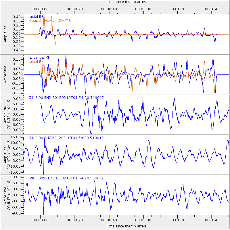
KIP Kipapa - Hawaii, USA - Earthquake Result Viewer
*The percent match for this event was below the threshold and hence no stack was calculated.
| Earthquake location: |
Fiji Islands Region |
| Earthquake latitude/longitude: |
-18.0/-178.5 |
| Earthquake time(UTC): |
2012/02/10 (041) 01:47:34 GMT |
| Earthquake Depth: |
582 km |
| Earthquake Magnitude: |
6.0 MB, 5.9 MW, 6.0 MW |
| Earthquake Catalog/Contributor: |
WHDF/NEIC |
|
| Network: |
G GEOSCOPE |
| Station: |
KIP Kipapa - Hawaii, USA |
| Lat/Lon: |
21.42 N/158.01 W |
| Elevation: |
70 m |
|
| Distance: |
44.0 deg |
| Az: |
28.057 deg |
| Baz: |
208.718 deg |
| Ray Param: |
$rayparam |
*The percent match for this event was below the threshold and hence was not used in the summary stack. |
|
| Radial Match: |
47.86183 % |
| Radial Bump: |
400 |
| Transverse Match: |
52.356247 % |
| Transverse Bump: |
400 |
| SOD ConfigId: |
558545 |
| Insert Time: |
2013-09-19 11:34:55.106 +0000 |
| GWidth: |
2.5 |
| Max Bumps: |
400 |
| Tol: |
0.001 |
|
Signal To Noise
| Channel | StoN | STA | LTA |
| G:KIP:00:BHZ:20120210T01:54:20.51901Z | 1.5980085 | 7.13498E-6 | 4.46492E-6 |
| G:KIP:00:BH1:20120210T01:54:20.51901Z | 1.1077243 | 3.0708134E-6 | 2.772182E-6 |
| G:KIP:00:BH2:20120210T01:54:20.51901Z | 2.398861 | 6.5037298E-6 | 2.7111741E-6 |
| Arrivals |
| Ps | |
| PpPs | |
| PsPs/PpSs | |


