You are here: Home > Network List > US - United States National Seismic Network Stations List
> Station DUG Dugway, Tooele County, Utah, USA > Earthquake Result Viewer
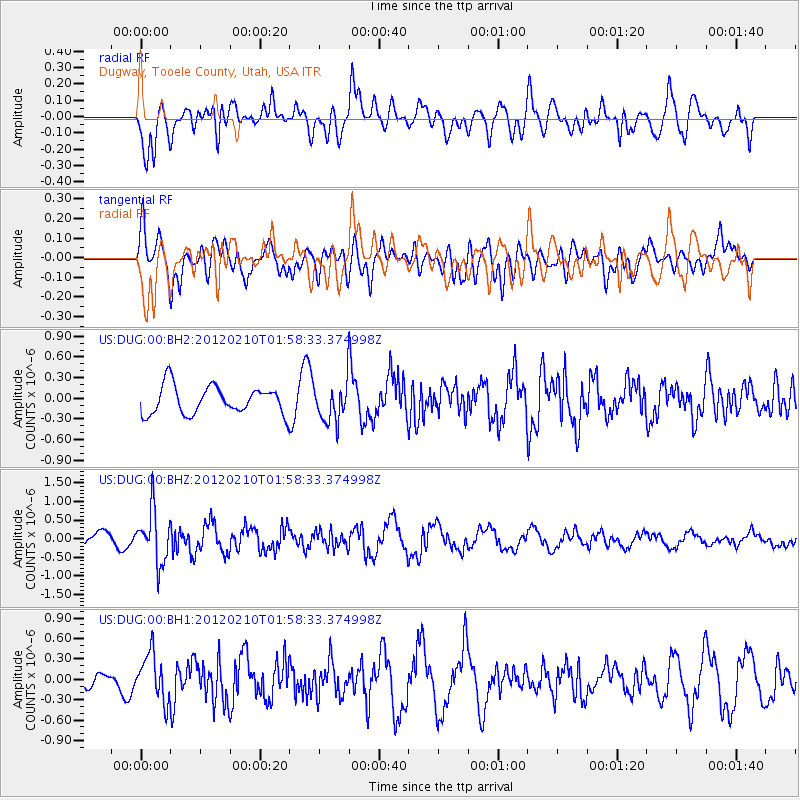
DUG Dugway, Tooele County, Utah, USA - Earthquake Result Viewer
*The percent match for this event was below the threshold and hence no stack was calculated.
| Earthquake location: |
Fiji Islands Region |
| Earthquake latitude/longitude: |
-18.0/-178.5 |
| Earthquake time(UTC): |
2012/02/10 (041) 01:47:34 GMT |
| Earthquake Depth: |
582 km |
| Earthquake Magnitude: |
6.0 MB, 5.9 MW, 6.0 MW |
| Earthquake Catalog/Contributor: |
WHDF/NEIC |
|
| Network: |
US United States National Seismic Network |
| Station: |
DUG Dugway, Tooele County, Utah, USA |
| Lat/Lon: |
40.19 N/112.81 W |
| Elevation: |
1477 m |
|
| Distance: |
84.1 deg |
| Az: |
44.589 deg |
| Baz: |
240.732 deg |
| Ray Param: |
$rayparam |
*The percent match for this event was below the threshold and hence was not used in the summary stack. |
|
| Radial Match: |
54.150627 % |
| Radial Bump: |
400 |
| Transverse Match: |
51.408318 % |
| Transverse Bump: |
400 |
| SOD ConfigId: |
558545 |
| Insert Time: |
2013-09-19 11:36:27.312 +0000 |
| GWidth: |
2.5 |
| Max Bumps: |
400 |
| Tol: |
0.001 |
|
Signal To Noise
| Channel | StoN | STA | LTA |
| US:DUG:00:BHZ:20120210T01:58:33.374998Z | 3.187036 | 6.982103E-7 | 2.1907826E-7 |
| US:DUG:00:BH1:20120210T01:58:33.374998Z | 1.8644865 | 3.4488775E-7 | 1.8497735E-7 |
| US:DUG:00:BH2:20120210T01:58:33.374998Z | 1.3672261 | 2.7639854E-7 | 2.0216008E-7 |
| Arrivals |
| Ps | |
| PpPs | |
| PsPs/PpSs | |


