You are here: Home > Network List > US - United States National Seismic Network Stations List
> Station DGMT Dagmar, Montana, USA > Earthquake Result Viewer
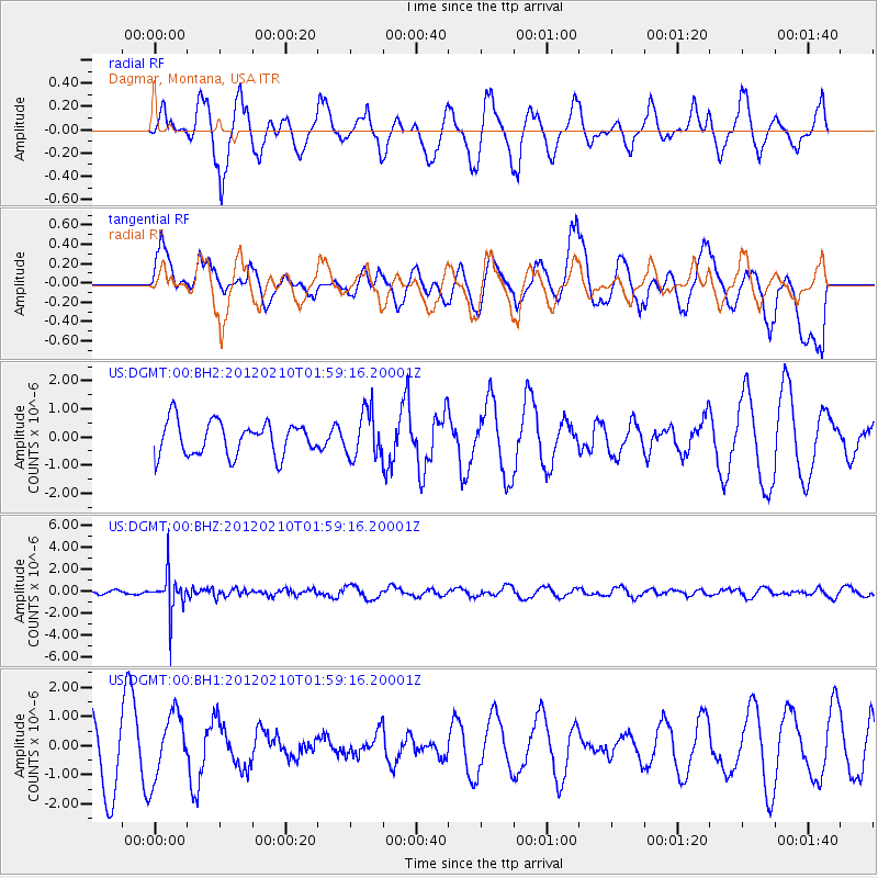
DGMT Dagmar, Montana, USA - Earthquake Result Viewer
*The percent match for this event was below the threshold and hence no stack was calculated.
| Earthquake location: |
Fiji Islands Region |
| Earthquake latitude/longitude: |
-18.0/-178.5 |
| Earthquake time(UTC): |
2012/02/10 (041) 01:47:34 GMT |
| Earthquake Depth: |
582 km |
| Earthquake Magnitude: |
6.0 MB, 5.9 MW, 6.0 MW |
| Earthquake Catalog/Contributor: |
WHDF/NEIC |
|
| Network: |
US United States National Seismic Network |
| Station: |
DGMT Dagmar, Montana, USA |
| Lat/Lon: |
48.47 N/104.20 W |
| Elevation: |
0.0 m |
|
| Distance: |
93.3 deg |
| Az: |
39.935 deg |
| Baz: |
246.651 deg |
| Ray Param: |
$rayparam |
*The percent match for this event was below the threshold and hence was not used in the summary stack. |
|
| Radial Match: |
57.998886 % |
| Radial Bump: |
335 |
| Transverse Match: |
42.49269 % |
| Transverse Bump: |
360 |
| SOD ConfigId: |
558545 |
| Insert Time: |
2013-09-19 11:36:27.525 +0000 |
| GWidth: |
2.5 |
| Max Bumps: |
400 |
| Tol: |
0.001 |
|
Signal To Noise
| Channel | StoN | STA | LTA |
| US:DGMT:00:BHZ:20120210T01:59:16.20001Z | 7.093534 | 1.7933934E-6 | 2.5282085E-7 |
| US:DGMT:00:BH1:20120210T01:59:16.20001Z | 0.87823534 | 1.1265533E-6 | 1.2827466E-6 |
| US:DGMT:00:BH2:20120210T01:59:16.20001Z | 1.3778836 | 8.2395957E-7 | 5.9798924E-7 |
| Arrivals |
| Ps | |
| PpPs | |
| PsPs/PpSs | |


