You are here: Home > Network List > IU - Global Seismograph Network (GSN - IRIS/USGS) Stations List
> Station MAKZ Makanchi, Kazakhstan > Earthquake Result Viewer
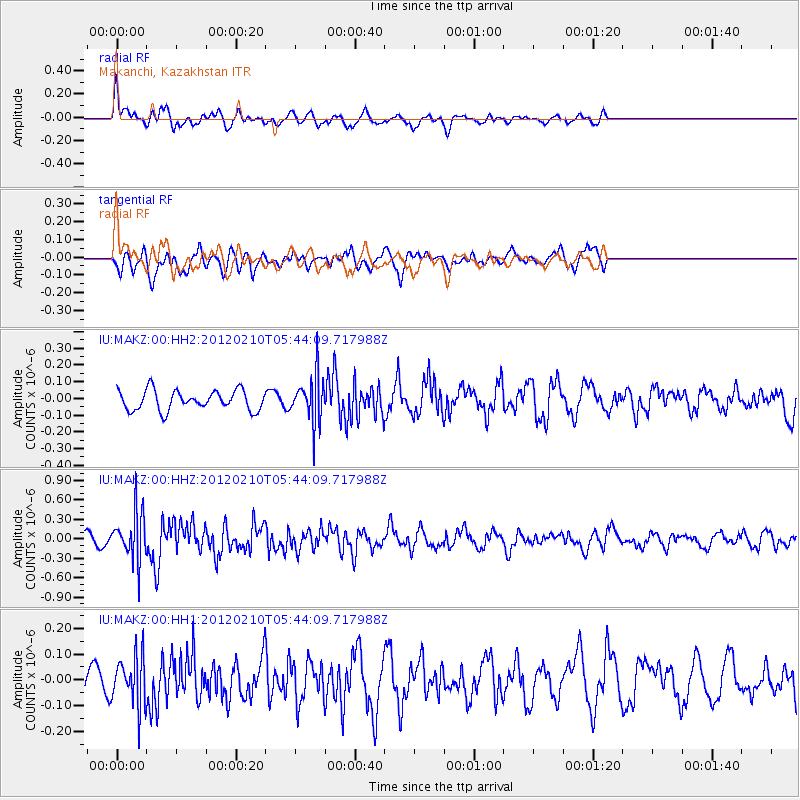
MAKZ Makanchi, Kazakhstan - Earthquake Result Viewer
*The percent match for this event was below the threshold and hence no stack was calculated.
| Earthquake location: |
Irian Jaya Region, Indonesia |
| Earthquake latitude/longitude: |
-0.3/132.7 |
| Earthquake time(UTC): |
2012/02/10 (041) 05:34:05 GMT |
| Earthquake Depth: |
15 km |
| Earthquake Magnitude: |
5.7 MW, 5.6 MB, 5.6 MW |
| Earthquake Catalog/Contributor: |
NEIC PDE/NEIC PDE-M |
|
| Network: |
IU Global Seismograph Network (GSN - IRIS/USGS) |
| Station: |
MAKZ Makanchi, Kazakhstan |
| Lat/Lon: |
46.81 N/81.98 E |
| Elevation: |
600 m |
|
| Distance: |
64.5 deg |
| Az: |
323.905 deg |
| Baz: |
120.944 deg |
| Ray Param: |
$rayparam |
*The percent match for this event was below the threshold and hence was not used in the summary stack. |
|
| Radial Match: |
69.04581 % |
| Radial Bump: |
400 |
| Transverse Match: |
47.392323 % |
| Transverse Bump: |
400 |
| SOD ConfigId: |
558545 |
| Insert Time: |
2013-09-19 11:38:38.930 +0000 |
| GWidth: |
2.5 |
| Max Bumps: |
400 |
| Tol: |
0.001 |
|
Signal To Noise
| Channel | StoN | STA | LTA |
| IU:MAKZ:00:HHZ:20120210T05:44:09.717988Z | 8.048623 | 3.7059834E-7 | 4.604494E-8 |
| IU:MAKZ:00:HH1:20120210T05:44:09.717988Z | 1.2191471 | 9.7005625E-8 | 7.956844E-8 |
| IU:MAKZ:00:HH2:20120210T05:44:09.717988Z | 2.3667886 | 1.4065859E-7 | 5.9430146E-8 |
| Arrivals |
| Ps | |
| PpPs | |
| PsPs/PpSs | |


