You are here: Home > Network List > IU - Global Seismograph Network (GSN - IRIS/USGS) Stations List
> Station JOHN Johnston Island, USA > Earthquake Result Viewer
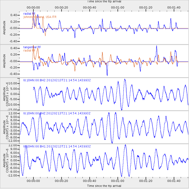
JOHN Johnston Island, USA - Earthquake Result Viewer
*The percent match for this event was below the threshold and hence no stack was calculated.
| Earthquake location: |
Northern California |
| Earthquake latitude/longitude: |
41.1/-123.8 |
| Earthquake time(UTC): |
2012/02/13 (044) 21:07:02 GMT |
| Earthquake Depth: |
28 km |
| Earthquake Magnitude: |
5.6 MW, 5.4 MS, 5.3 MB, 5.6 MW |
| Earthquake Catalog/Contributor: |
WHDF/NEIC |
|
| Network: |
IU Global Seismograph Network (GSN - IRIS/USGS) |
| Station: |
JOHN Johnston Island, USA |
| Lat/Lon: |
16.73 N/169.53 W |
| Elevation: |
2.0 m |
|
| Distance: |
46.2 deg |
| Az: |
252.058 deg |
| Baz: |
48.58 deg |
| Ray Param: |
$rayparam |
*The percent match for this event was below the threshold and hence was not used in the summary stack. |
|
| Radial Match: |
54.818226 % |
| Radial Bump: |
400 |
| Transverse Match: |
68.242355 % |
| Transverse Bump: |
400 |
| SOD ConfigId: |
558545 |
| Insert Time: |
2013-09-19 11:48:06.126 +0000 |
| GWidth: |
2.5 |
| Max Bumps: |
400 |
| Tol: |
0.001 |
|
Signal To Noise
| Channel | StoN | STA | LTA |
| IU:JOHN:00:BHZ:20120213T21:14:54.143993Z | 1.3796259 | 8.345377E-6 | 6.0490147E-6 |
| IU:JOHN:00:BH1:20120213T21:14:54.143993Z | 0.31267565 | 1.5584295E-6 | 4.984173E-6 |
| IU:JOHN:00:BH2:20120213T21:14:54.143993Z | 0.8381149 | 3.6386825E-6 | 4.341508E-6 |
| Arrivals |
| Ps | |
| PpPs | |
| PsPs/PpSs | |


