You are here: Home > Network List > II - Global Seismograph Network (GSN - IRIS/IDA) Stations List
> Station WRAB Tennant Creek, NT, Australia > Earthquake Result Viewer
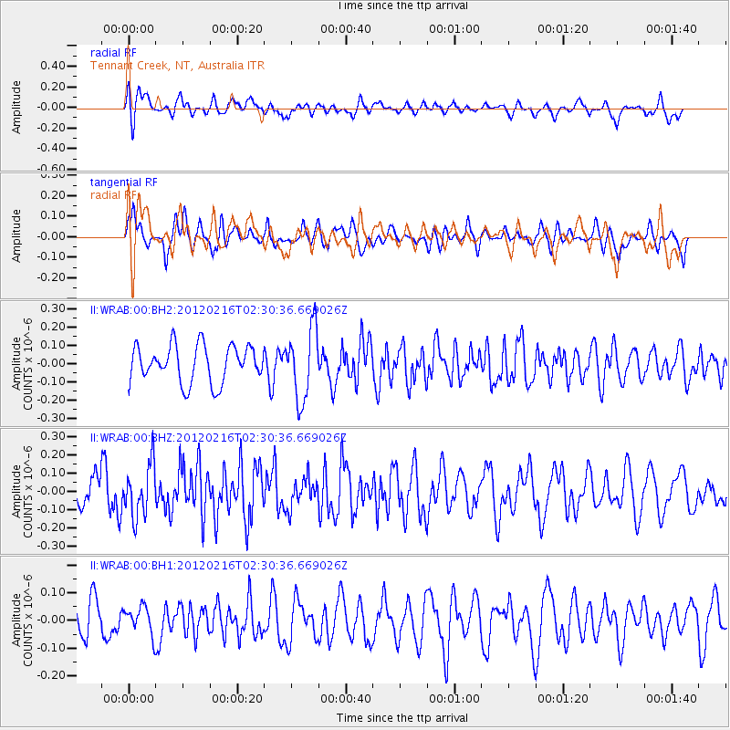
WRAB Tennant Creek, NT, Australia - Earthquake Result Viewer
*The percent match for this event was below the threshold and hence no stack was calculated.
| Earthquake location: |
Mauritius - Reunion Region |
| Earthquake latitude/longitude: |
-17.8/65.4 |
| Earthquake time(UTC): |
2012/02/16 (047) 02:20:28 GMT |
| Earthquake Depth: |
10 km |
| Earthquake Magnitude: |
5.8 MW, 5.8 MW |
| Earthquake Catalog/Contributor: |
NEIC PDE/NEIC PDE-M |
|
| Network: |
II Global Seismograph Network (GSN - IRIS/IDA) |
| Station: |
WRAB Tennant Creek, NT, Australia |
| Lat/Lon: |
19.93 S/134.36 E |
| Elevation: |
366 m |
|
| Distance: |
64.8 deg |
| Az: |
104.063 deg |
| Baz: |
259.141 deg |
| Ray Param: |
$rayparam |
*The percent match for this event was below the threshold and hence was not used in the summary stack. |
|
| Radial Match: |
41.43334 % |
| Radial Bump: |
400 |
| Transverse Match: |
57.26309 % |
| Transverse Bump: |
400 |
| SOD ConfigId: |
558545 |
| Insert Time: |
2013-09-19 12:07:07.912 +0000 |
| GWidth: |
2.5 |
| Max Bumps: |
400 |
| Tol: |
0.001 |
|
Signal To Noise
| Channel | StoN | STA | LTA |
| II:WRAB:00:BHZ:20120216T02:30:36.669026Z | 1.7876278 | 1.4337553E-7 | 8.020435E-8 |
| II:WRAB:00:BH1:20120216T02:30:36.669026Z | 0.7083972 | 5.023245E-8 | 7.0910005E-8 |
| II:WRAB:00:BH2:20120216T02:30:36.669026Z | 1.9471856 | 1.9622347E-7 | 1.00772866E-7 |
| Arrivals |
| Ps | |
| PpPs | |
| PsPs/PpSs | |


