You are here: Home > Network List > US - United States National Seismic Network Stations List
> Station EGMT Eagleton, Montana, USA > Earthquake Result Viewer
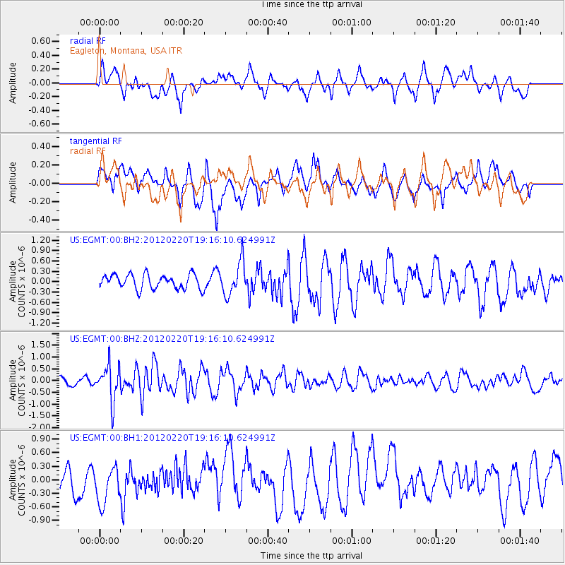
EGMT Eagleton, Montana, USA - Earthquake Result Viewer
*The percent match for this event was below the threshold and hence no stack was calculated.
| Earthquake location: |
Near Coast Of Chiapas, Mexico |
| Earthquake latitude/longitude: |
14.3/-92.8 |
| Earthquake time(UTC): |
2012/02/20 (051) 19:09:36 GMT |
| Earthquake Depth: |
10 km |
| Earthquake Magnitude: |
5.6 MW |
| Earthquake Catalog/Contributor: |
NEIC PDE/NEIC PDE-M |
|
| Network: |
US United States National Seismic Network |
| Station: |
EGMT Eagleton, Montana, USA |
| Lat/Lon: |
48.02 N/109.75 W |
| Elevation: |
1055 m |
|
| Distance: |
36.5 deg |
| Az: |
340.75 deg |
| Baz: |
151.566 deg |
| Ray Param: |
$rayparam |
*The percent match for this event was below the threshold and hence was not used in the summary stack. |
|
| Radial Match: |
54.527454 % |
| Radial Bump: |
400 |
| Transverse Match: |
71.58499 % |
| Transverse Bump: |
400 |
| SOD ConfigId: |
558545 |
| Insert Time: |
2013-09-19 12:10:13.035 +0000 |
| GWidth: |
2.5 |
| Max Bumps: |
400 |
| Tol: |
0.001 |
|
Signal To Noise
| Channel | StoN | STA | LTA |
| US:EGMT:00:BHZ:20120220T19:16:10.624991Z | 4.4806933 | 7.863696E-7 | 1.7550177E-7 |
| US:EGMT:00:BH1:20120220T19:16:10.624991Z | 1.3310685 | 4.4416973E-7 | 3.3369412E-7 |
| US:EGMT:00:BH2:20120220T19:16:10.624991Z | 2.428651 | 5.033935E-7 | 2.0727288E-7 |
| Arrivals |
| Ps | |
| PpPs | |
| PsPs/PpSs | |


