You are here: Home > Network List > TA - USArray Transportable Network (new EarthScope stations) Stations List
> Station J04D Umpqua National Forest, Toketee, OR, USA > Earthquake Result Viewer
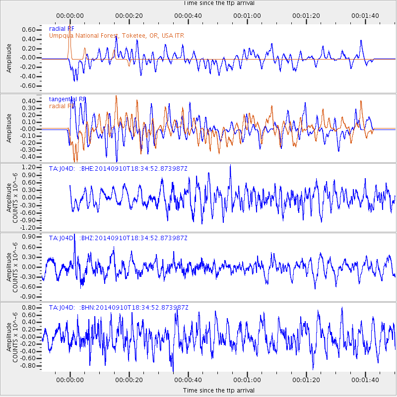
J04D Umpqua National Forest, Toketee, OR, USA - Earthquake Result Viewer
*The percent match for this event was below the threshold and hence no stack was calculated.
| Earthquake location: |
Rat Islands, Aleutian Islands |
| Earthquake latitude/longitude: |
52.1/178.3 |
| Earthquake time(UTC): |
2014/09/10 (253) 18:28:00 GMT |
| Earthquake Depth: |
125 km |
| Earthquake Magnitude: |
5.3 MW |
| Earthquake Catalog/Contributor: |
ISC/ISC |
|
| Network: |
TA USArray Transportable Network (new EarthScope stations) |
| Station: |
J04D Umpqua National Forest, Toketee, OR, USA |
| Lat/Lon: |
43.24 N/122.11 W |
| Elevation: |
1948 m |
|
| Distance: |
40.1 deg |
| Az: |
78.327 deg |
| Baz: |
304.201 deg |
| Ray Param: |
$rayparam |
*The percent match for this event was below the threshold and hence was not used in the summary stack. |
|
| Radial Match: |
58.88679 % |
| Radial Bump: |
400 |
| Transverse Match: |
52.01842 % |
| Transverse Bump: |
400 |
| SOD ConfigId: |
3390531 |
| Insert Time: |
2019-04-13 23:49:49.701 +0000 |
| GWidth: |
2.5 |
| Max Bumps: |
400 |
| Tol: |
0.001 |
|
Signal To Noise
| Channel | StoN | STA | LTA |
| TA:J04D: :BHZ:20140910T18:34:52.873987Z | 1.6942301 | 3.3517554E-7 | 1.9783354E-7 |
| TA:J04D: :BHN:20140910T18:34:52.873987Z | 0.9886777 | 2.0410634E-7 | 2.0644376E-7 |
| TA:J04D: :BHE:20140910T18:34:52.873987Z | 1.4641652 | 4.1670467E-7 | 2.846022E-7 |
| Arrivals |
| Ps | |
| PpPs | |
| PsPs/PpSs | |


