You are here: Home > Network List > US - United States National Seismic Network Stations List
> Station HAWA Hanford, Washington, USA > Earthquake Result Viewer
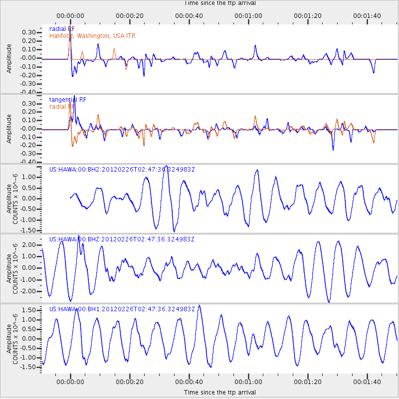
HAWA Hanford, Washington, USA - Earthquake Result Viewer
*The percent match for this event was below the threshold and hence no stack was calculated.
| Earthquake location: |
Taiwan |
| Earthquake latitude/longitude: |
22.7/120.9 |
| Earthquake time(UTC): |
2012/02/26 (057) 02:35:00 GMT |
| Earthquake Depth: |
28 km |
| Earthquake Magnitude: |
5.9 MB, 5.7 MS, 5.9 MW, 5.8 MW |
| Earthquake Catalog/Contributor: |
WHDF/NEIC |
|
| Network: |
US United States National Seismic Network |
| Station: |
HAWA Hanford, Washington, USA |
| Lat/Lon: |
46.39 N/119.53 W |
| Elevation: |
364 m |
|
| Distance: |
92.2 deg |
| Az: |
37.043 deg |
| Baz: |
306.489 deg |
| Ray Param: |
$rayparam |
*The percent match for this event was below the threshold and hence was not used in the summary stack. |
|
| Radial Match: |
55.29472 % |
| Radial Bump: |
400 |
| Transverse Match: |
74.29126 % |
| Transverse Bump: |
339 |
| SOD ConfigId: |
558545 |
| Insert Time: |
2013-09-19 12:17:13.255 +0000 |
| GWidth: |
2.5 |
| Max Bumps: |
400 |
| Tol: |
0.001 |
|
Signal To Noise
| Channel | StoN | STA | LTA |
| US:HAWA:00:BHZ:20120226T02:47:36.324983Z | 1.7503551 | 1.9087731E-6 | 1.0905062E-6 |
| US:HAWA:00:BH1:20120226T02:47:36.324983Z | 1.0592933 | 1.0021579E-6 | 9.460628E-7 |
| US:HAWA:00:BH2:20120226T02:47:36.324983Z | 3.322904 | 1.0661984E-6 | 3.2086342E-7 |
| Arrivals |
| Ps | |
| PpPs | |
| PsPs/PpSs | |


