You are here: Home > Network List > US - United States National Seismic Network Stations List
> Station HAWA Hanford, Washington, USA > Earthquake Result Viewer
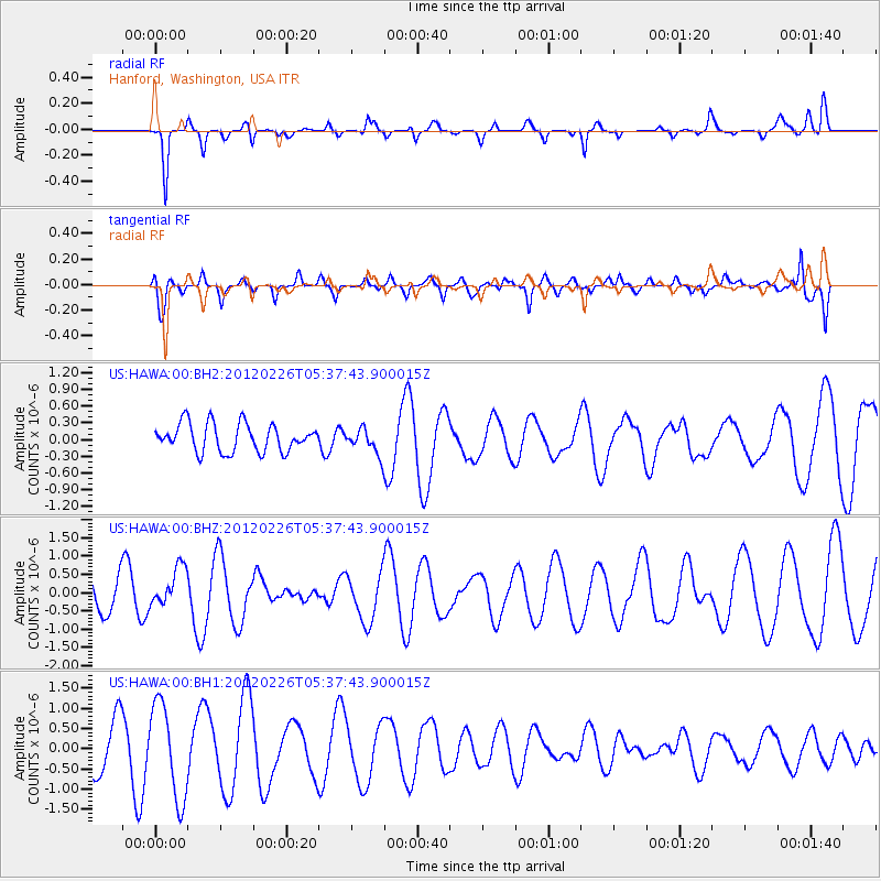
HAWA Hanford, Washington, USA - Earthquake Result Viewer
*The percent match for this event was below the threshold and hence no stack was calculated.
| Earthquake location: |
South Of Kermadec Islands |
| Earthquake latitude/longitude: |
-32.5/-177.7 |
| Earthquake time(UTC): |
2012/02/26 (057) 05:24:59 GMT |
| Earthquake Depth: |
39 km |
| Earthquake Magnitude: |
5.6 MB |
| Earthquake Catalog/Contributor: |
NEIC PDE/NEIC PDE-M |
|
| Network: |
US United States National Seismic Network |
| Station: |
HAWA Hanford, Washington, USA |
| Lat/Lon: |
46.39 N/119.53 W |
| Elevation: |
364 m |
|
| Distance: |
94.5 deg |
| Az: |
36.158 deg |
| Baz: |
226.085 deg |
| Ray Param: |
$rayparam |
*The percent match for this event was below the threshold and hence was not used in the summary stack. |
|
| Radial Match: |
50.320618 % |
| Radial Bump: |
294 |
| Transverse Match: |
57.346195 % |
| Transverse Bump: |
400 |
| SOD ConfigId: |
558545 |
| Insert Time: |
2013-09-19 12:25:08.058 +0000 |
| GWidth: |
2.5 |
| Max Bumps: |
400 |
| Tol: |
0.001 |
|
Signal To Noise
| Channel | StoN | STA | LTA |
| US:HAWA:00:BHZ:20120226T05:37:43.900015Z | 1.1529157 | 5.43185E-7 | 4.7114028E-7 |
| US:HAWA:00:BH1:20120226T05:37:43.900015Z | 2.3474786 | 1.1706595E-6 | 4.9868805E-7 |
| US:HAWA:00:BH2:20120226T05:37:43.900015Z | 0.939806 | 2.3374335E-7 | 2.4871449E-7 |
| Arrivals |
| Ps | |
| PpPs | |
| PsPs/PpSs | |


