You are here: Home > Network List > US - United States National Seismic Network Stations List
> Station WUAZ Wupatki, Arizona, USA > Earthquake Result Viewer
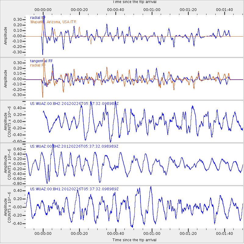
WUAZ Wupatki, Arizona, USA - Earthquake Result Viewer
*The percent match for this event was below the threshold and hence no stack was calculated.
| Earthquake location: |
South Of Kermadec Islands |
| Earthquake latitude/longitude: |
-32.5/-177.7 |
| Earthquake time(UTC): |
2012/02/26 (057) 05:24:59 GMT |
| Earthquake Depth: |
39 km |
| Earthquake Magnitude: |
5.6 MB |
| Earthquake Catalog/Contributor: |
NEIC PDE/NEIC PDE-M |
|
| Network: |
US United States National Seismic Network |
| Station: |
WUAZ Wupatki, Arizona, USA |
| Lat/Lon: |
35.52 N/111.37 W |
| Elevation: |
1592 m |
|
| Distance: |
91.9 deg |
| Az: |
48.392 deg |
| Baz: |
230.764 deg |
| Ray Param: |
$rayparam |
*The percent match for this event was below the threshold and hence was not used in the summary stack. |
|
| Radial Match: |
40.100418 % |
| Radial Bump: |
400 |
| Transverse Match: |
51.06141 % |
| Transverse Bump: |
400 |
| SOD ConfigId: |
558545 |
| Insert Time: |
2013-09-19 12:25:24.618 +0000 |
| GWidth: |
2.5 |
| Max Bumps: |
400 |
| Tol: |
0.001 |
|
Signal To Noise
| Channel | StoN | STA | LTA |
| US:WUAZ:00:BHZ:20120226T05:37:32.098989Z | 1.6144298 | 4.3521624E-7 | 2.6957892E-7 |
| US:WUAZ:00:BH1:20120226T05:37:32.098989Z | 0.49897087 | 1.0579553E-7 | 2.1202746E-7 |
| US:WUAZ:00:BH2:20120226T05:37:32.098989Z | 0.94630754 | 2.0296677E-7 | 2.1448288E-7 |
| Arrivals |
| Ps | |
| PpPs | |
| PsPs/PpSs | |


