You are here: Home > Network List > US - United States National Seismic Network Stations List
> Station MSO Missoula, Montana, USA > Earthquake Result Viewer
MSO Missoula, Montana, USA - Earthquake Result Viewer
*The percent match for this event was below the threshold and hence no stack was calculated.
| Earthquake location: |
Rat Islands, Aleutian Islands |
| Earthquake latitude/longitude: |
52.1/178.3 |
| Earthquake time(UTC): |
2014/09/10 (253) 18:28:00 GMT |
| Earthquake Depth: |
125 km |
| Earthquake Magnitude: |
5.3 MW |
| Earthquake Catalog/Contributor: |
ISC/ISC |
|
| Network: |
US United States National Seismic Network |
| Station: |
MSO Missoula, Montana, USA |
| Lat/Lon: |
46.83 N/113.94 W |
| Elevation: |
1264 m |
|
| Distance: |
42.9 deg |
| Az: |
68.983 deg |
| Baz: |
302.96 deg |
| Ray Param: |
$rayparam |
*The percent match for this event was below the threshold and hence was not used in the summary stack. |
|
| Radial Match: |
58.67232 % |
| Radial Bump: |
400 |
| Transverse Match: |
65.52646 % |
| Transverse Bump: |
400 |
| SOD ConfigId: |
3390531 |
| Insert Time: |
2019-04-13 23:51:12.571 +0000 |
| GWidth: |
2.5 |
| Max Bumps: |
400 |
| Tol: |
0.001 |
|
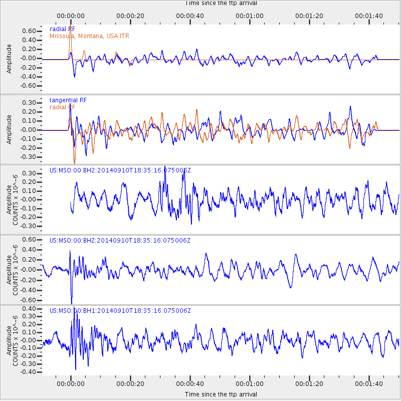
Signal To Noise
| Channel | StoN | STA | LTA |
| US:MSO:00:BHZ:20140910T18:35:16.075006Z | 2.0317845 | 2.1693151E-7 | 1.0676896E-7 |
| US:MSO:00:BH1:20140910T18:35:16.075006Z | 2.3911946 | 1.8443438E-7 | 7.713065E-8 |
| US:MSO:00:BH2:20140910T18:35:16.075006Z | 1.4991176 | 1.4262108E-7 | 9.5136684E-8 |
| Arrivals |
| Ps | |
| PpPs | |
| PsPs/PpSs | |


