
TZTN Tazewell, Tennessee, USA - Earthquake Result Viewer
| ||||||||||||||||||
| ||||||||||||||||||
| ||||||||||||||||||
|
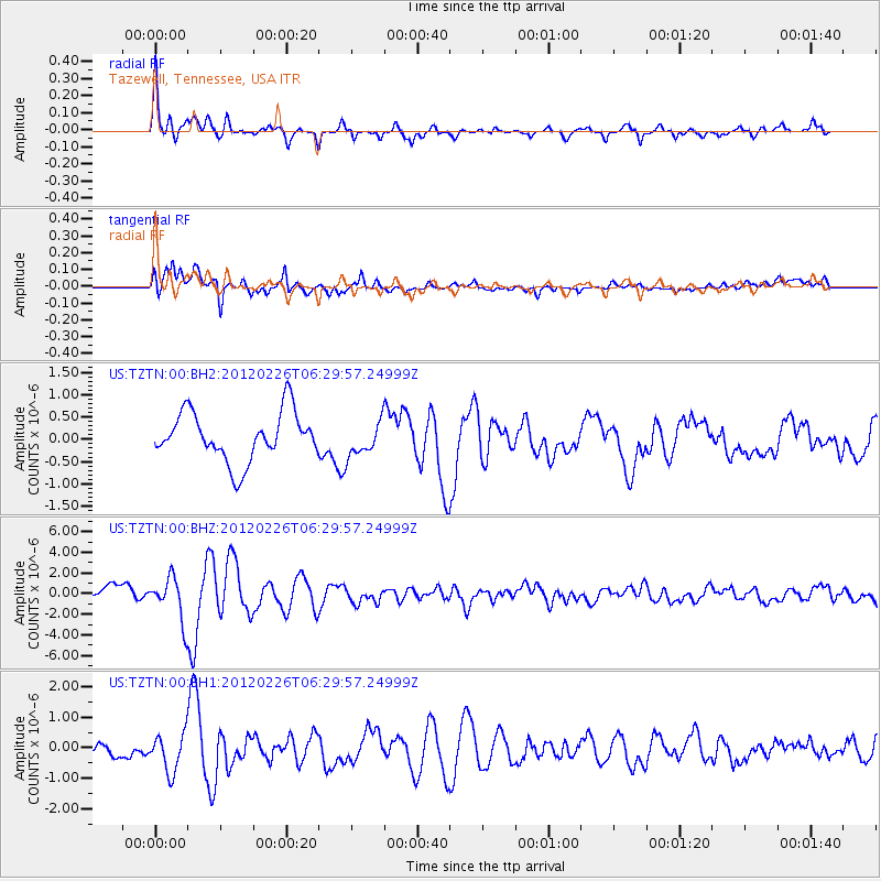
Signal To Noise
| Channel | StoN | STA | LTA |
| US:TZTN:00:BHZ:20120226T06:29:57.24999Z | 2.5578701 | 2.0878228E-6 | 8.162349E-7 |
| US:TZTN:00:BH1:20120226T06:29:57.24999Z | 1.8713146 | 6.249663E-7 | 3.339718E-7 |
| US:TZTN:00:BH2:20120226T06:29:57.24999Z | 0.69444484 | 3.778534E-7 | 5.441086E-7 |
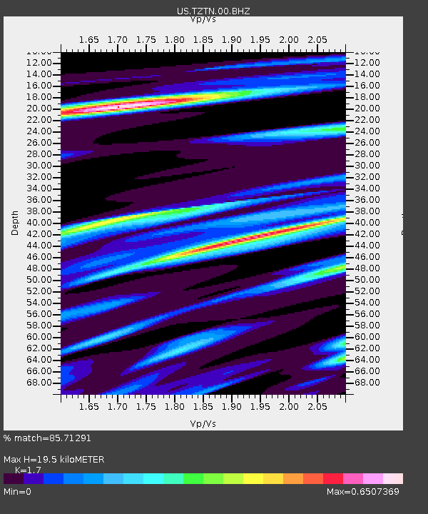
| Arrivals | |
| Ps | 2.2 SECOND |
| PpPs | 8.0 SECOND |
| PsPs/PpSs | 10 SECOND |

