You are here: Home > Network List > US - United States National Seismic Network Stations List
> Station WUAZ Wupatki, Arizona, USA > Earthquake Result Viewer
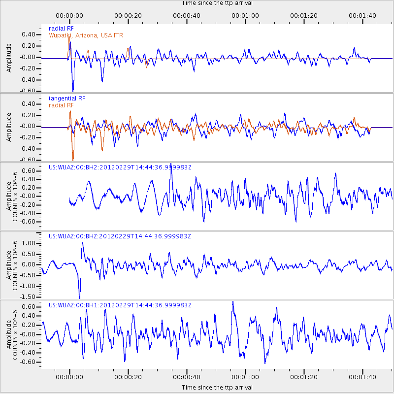
WUAZ Wupatki, Arizona, USA - Earthquake Result Viewer
*The percent match for this event was below the threshold and hence no stack was calculated.
| Earthquake location: |
Near East Coast Of Honshu, Japan |
| Earthquake latitude/longitude: |
35.2/141.0 |
| Earthquake time(UTC): |
2012/02/29 (060) 14:32:47 GMT |
| Earthquake Depth: |
26 km |
| Earthquake Magnitude: |
5.6 MB, 5.5 MS, 5.6 MW, 5.7 MW |
| Earthquake Catalog/Contributor: |
WHDF/NEIC |
|
| Network: |
US United States National Seismic Network |
| Station: |
WUAZ Wupatki, Arizona, USA |
| Lat/Lon: |
35.52 N/111.37 W |
| Elevation: |
1592 m |
|
| Distance: |
82.6 deg |
| Az: |
51.638 deg |
| Baz: |
308.079 deg |
| Ray Param: |
$rayparam |
*The percent match for this event was below the threshold and hence was not used in the summary stack. |
|
| Radial Match: |
68.77508 % |
| Radial Bump: |
400 |
| Transverse Match: |
55.843456 % |
| Transverse Bump: |
400 |
| SOD ConfigId: |
558545 |
| Insert Time: |
2013-09-19 12:46:09.644 +0000 |
| GWidth: |
2.5 |
| Max Bumps: |
400 |
| Tol: |
0.001 |
|
Signal To Noise
| Channel | StoN | STA | LTA |
| US:WUAZ:00:BHZ:20120229T14:44:36.999983Z | 3.7619734 | 5.913425E-7 | 1.5718943E-7 |
| US:WUAZ:00:BH1:20120229T14:44:36.999983Z | 1.2443297 | 2.1339552E-7 | 1.7149435E-7 |
| US:WUAZ:00:BH2:20120229T14:44:36.999983Z | 1.9310182 | 3.1107498E-7 | 1.6109377E-7 |
| Arrivals |
| Ps | |
| PpPs | |
| PsPs/PpSs | |


