You are here: Home > Network List > US - United States National Seismic Network Stations List
> Station AMTX Amarillo, Texas, USA > Earthquake Result Viewer
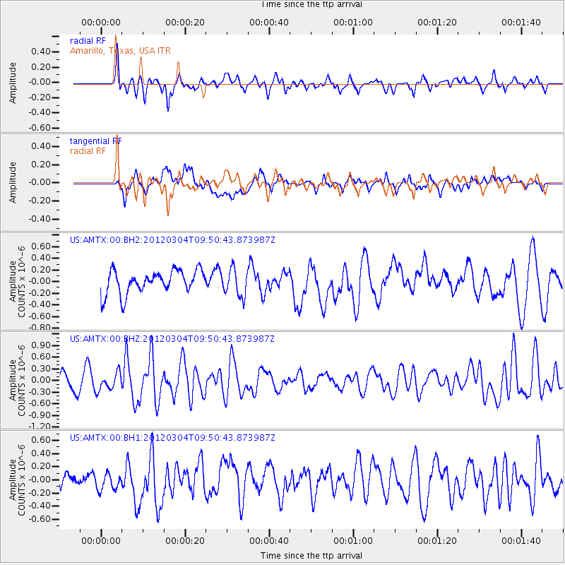
AMTX Amarillo, Texas, USA - Earthquake Result Viewer
*The percent match for this event was below the threshold and hence no stack was calculated.
| Earthquake location: |
Off Coast Of Central America |
| Earthquake latitude/longitude: |
2.7/-84.3 |
| Earthquake time(UTC): |
2012/03/04 (064) 09:44:14 GMT |
| Earthquake Depth: |
9.0 km |
| Earthquake Magnitude: |
5.5 MB, 5.5 MW |
| Earthquake Catalog/Contributor: |
NEIC PDE/NEIC PDE-M |
|
| Network: |
US United States National Seismic Network |
| Station: |
AMTX Amarillo, Texas, USA |
| Lat/Lon: |
34.53 N/101.41 W |
| Elevation: |
1010 m |
|
| Distance: |
35.4 deg |
| Az: |
335.302 deg |
| Baz: |
149.632 deg |
| Ray Param: |
$rayparam |
*The percent match for this event was below the threshold and hence was not used in the summary stack. |
|
| Radial Match: |
66.17336 % |
| Radial Bump: |
400 |
| Transverse Match: |
52.19523 % |
| Transverse Bump: |
400 |
| SOD ConfigId: |
558545 |
| Insert Time: |
2013-09-19 12:58:47.449 +0000 |
| GWidth: |
2.5 |
| Max Bumps: |
400 |
| Tol: |
0.001 |
|
Signal To Noise
| Channel | StoN | STA | LTA |
| US:AMTX:00:BHZ:20120304T09:50:43.873987Z | 1.2690707 | 2.1205135E-7 | 1.6709184E-7 |
| US:AMTX:00:BH1:20120304T09:50:43.873987Z | 0.74393857 | 1.6127684E-7 | 2.1678785E-7 |
| US:AMTX:00:BH2:20120304T09:50:43.873987Z | 0.99050164 | 1.9779415E-7 | 1.996909E-7 |
| Arrivals |
| Ps | |
| PpPs | |
| PsPs/PpSs | |


