You are here: Home > Network List > US - United States National Seismic Network Stations List
> Station MSO Missoula, Montana, USA > Earthquake Result Viewer
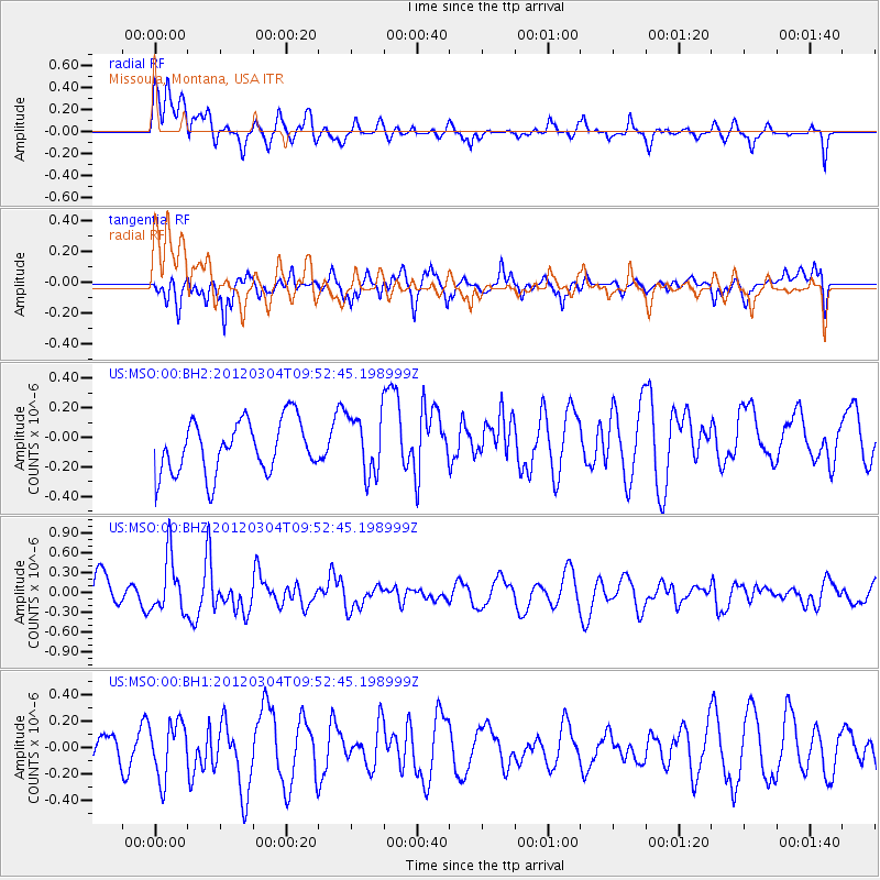
MSO Missoula, Montana, USA - Earthquake Result Viewer
*The percent match for this event was below the threshold and hence no stack was calculated.
| Earthquake location: |
Off Coast Of Central America |
| Earthquake latitude/longitude: |
2.7/-84.3 |
| Earthquake time(UTC): |
2012/03/04 (064) 09:44:14 GMT |
| Earthquake Depth: |
9.0 km |
| Earthquake Magnitude: |
5.5 MB, 5.5 MW |
| Earthquake Catalog/Contributor: |
NEIC PDE/NEIC PDE-M |
|
| Network: |
US United States National Seismic Network |
| Station: |
MSO Missoula, Montana, USA |
| Lat/Lon: |
46.83 N/113.94 W |
| Elevation: |
1264 m |
|
| Distance: |
50.9 deg |
| Az: |
334.099 deg |
| Baz: |
140.543 deg |
| Ray Param: |
$rayparam |
*The percent match for this event was below the threshold and hence was not used in the summary stack. |
|
| Radial Match: |
66.144196 % |
| Radial Bump: |
400 |
| Transverse Match: |
71.79686 % |
| Transverse Bump: |
400 |
| SOD ConfigId: |
558545 |
| Insert Time: |
2013-09-19 12:59:49.372 +0000 |
| GWidth: |
2.5 |
| Max Bumps: |
400 |
| Tol: |
0.001 |
|
Signal To Noise
| Channel | StoN | STA | LTA |
| US:MSO:00:BHZ:20120304T09:52:45.198999Z | 1.5289166 | 4.2284165E-7 | 2.7656293E-7 |
| US:MSO:00:BH1:20120304T09:52:45.198999Z | 1.0835142 | 2.1068706E-7 | 1.944479E-7 |
| US:MSO:00:BH2:20120304T09:52:45.198999Z | 1.1349545 | 2.0206541E-7 | 1.7803833E-7 |
| Arrivals |
| Ps | |
| PpPs | |
| PsPs/PpSs | |


