You are here: Home > Network List > US - United States National Seismic Network Stations List
> Station DGMT Dagmar, Montana, USA > Earthquake Result Viewer
DGMT Dagmar, Montana, USA - Earthquake Result Viewer
*The percent match for this event was below the threshold and hence no stack was calculated.
| Earthquake location: |
Santiago Del Estero Prov., Arg. |
| Earthquake latitude/longitude: |
-28.2/-63.3 |
| Earthquake time(UTC): |
2012/03/05 (065) 07:46:10 GMT |
| Earthquake Depth: |
554 km |
| Earthquake Magnitude: |
6.0 MB, 6.1 MW, 6.1 MW |
| Earthquake Catalog/Contributor: |
WHDF/NEIC |
|
| Network: |
US United States National Seismic Network |
| Station: |
DGMT Dagmar, Montana, USA |
| Lat/Lon: |
48.47 N/104.20 W |
| Elevation: |
0.0 m |
|
| Distance: |
84.7 deg |
| Az: |
334.048 deg |
| Baz: |
144.54 deg |
| Ray Param: |
$rayparam |
*The percent match for this event was below the threshold and hence was not used in the summary stack. |
|
| Radial Match: |
59.280685 % |
| Radial Bump: |
368 |
| Transverse Match: |
40.97832 % |
| Transverse Bump: |
400 |
| SOD ConfigId: |
558545 |
| Insert Time: |
2013-09-19 13:08:29.335 +0000 |
| GWidth: |
2.5 |
| Max Bumps: |
400 |
| Tol: |
0.001 |
|
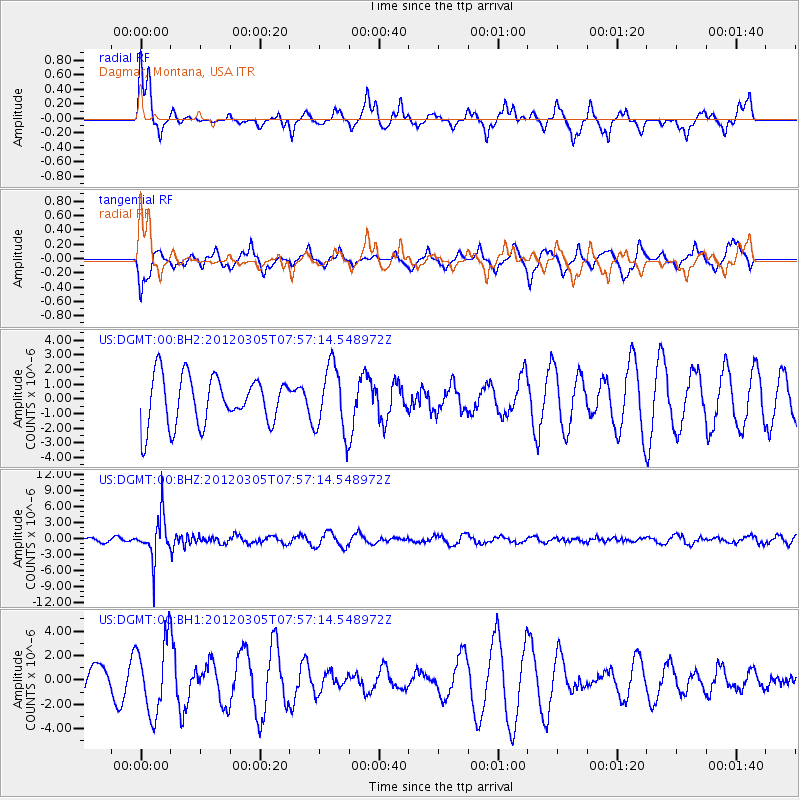
Signal To Noise
| Channel | StoN | STA | LTA |
| US:DGMT:00:BHZ:20120305T07:57:14.548972Z | 8.7091255 | 4.0919385E-6 | 4.6984493E-7 |
| US:DGMT:00:BH1:20120305T07:57:14.548972Z | 1.539467 | 2.9644682E-6 | 1.9256458E-6 |
| US:DGMT:00:BH2:20120305T07:57:14.548972Z | 1.3801174 | 2.2816155E-6 | 1.653204E-6 |
| Arrivals |
| Ps | |
| PpPs | |
| PsPs/PpSs | |


